Weather Xtreme: A Few Showers & Storms This Afternoon
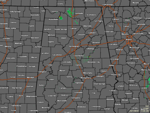
THIS MORNING: Radar as of 6 am shows that all of Central Alabama is dry this morning, with the only shower activity showing up over portions of Lawrence, Limestone, and Morgan counties. Temperatures as of the 5 o’clock round up were in the upper 60s to the lower 70s. Anniston, Birmingham, Eufaula, and Tuscaloosa were all tied at 73º for the warm spots, while Haleyville and Talladega were tied for the cool spots at 68 degrees.
THIS WEEKEND: A trough axis will move through the area that will help with the development of a few showers and thunderstorms today, but overall chances remain rather small for much of the area. Skies will be partly to mostly sunny, with highs in the mid 80s to the lower 90s. Sunday is trending drier and warmer as ridging starts to take over our weather pattern. Skies will be partly to mostly sunny, with only a slight chance of a few isolated showers or storms. Highs in the upper 80s to the lower 90s.
THE WORK WEEK AHEAD: The rinse and repeat forecast is back for the work week ahead as each day will feature partly sunny skies with the daily chance of isolated to scattered afternoon showers and thunderstorms as ridging will control the pattern. Highs on each day will be in the upper 80s to the lower 90s across the area, except for a few mid 90s on Monday in the southern parts of Central Alabama.
NEXT WEEKEND: Stepping off into Voodoo Land, next weekend looks to be more of the same, with partly to mostly sunny skies and only a small chance of an afternoon shower or storm. Temperatures continue to trend in the seasonal range for this time of the year.
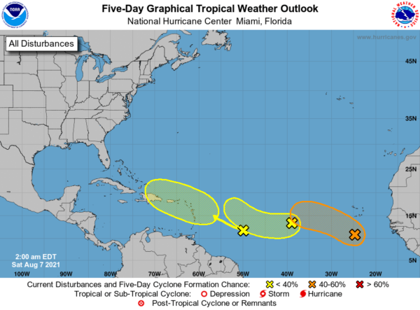
THE TROPICS: There are three areas of interest in the tropical Atlantic, which is no surprise as we are starting to get close to the peak of the hurricane season. The lead tropical wave is producing very limited shower activity and is not expected to develop any further. The middle system has only a low chance of development as it drifts westward over the weekend. The trailing system is producing a large area of showers and storms, but remains disorganized at this point. Conditions are only expected to become marginally conducive for development, and a depression may form by the beginning to the middle of the work week ahead.
Category: Alabama's Weather, ALL POSTS, Tropical


