Humid Days With Scattered Storms
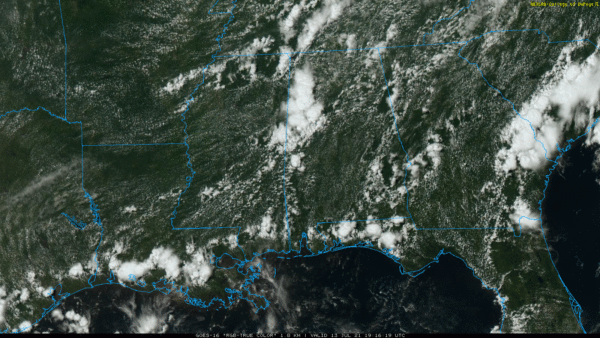
RADAR CHECK: Again this afternoon we have scattered showers and thunderstorms in progress across Alabama. Stronger storms at mid-afternoon were west of I-65, and were producing very heavy rain, gusty winds, and lots of lightning. Away from the showers the sky is partly sunny with temperatures mostly in the mid 80s. Storms will fade away tonight after sunset.
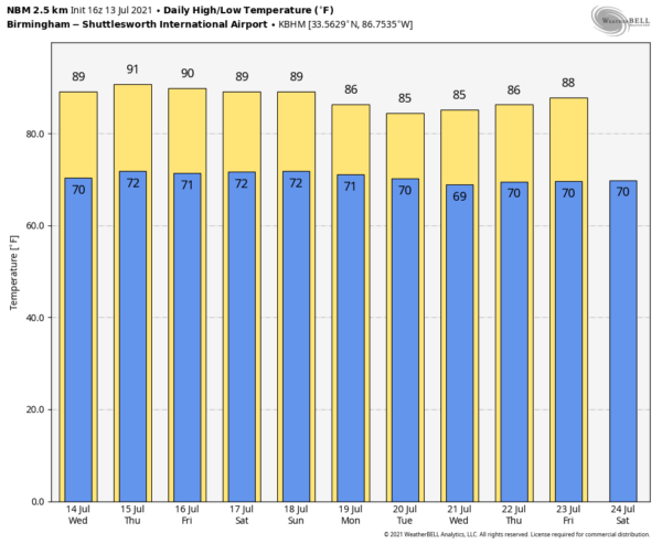
An upper ridge will try and build across the region in the short term; we believe showers and storms will be fewer in number tomorrow and Thursday… look for a partly sunny sky both days with a high in the upper 80s. Afternoon thunderstorms should be more widely spaced; odds of any one spot getting wet both days will be in the 25-35 percent range.
FRIDAY AND THE WEEKEND: Another upper trough sets up a little west of Alabama, so coverage of scattered showers and storms will likely increase again by Friday and the weekend. Still, no “washout”, the sun will be out at times with highs in the mid 80s. Just be ready for scattered to numerous showers and thunderstorms each day, especially during the afternoon and evening hours between 1:00 and 11:00 p.m.
NEXT WEEK: The persistent summer pattern stays in place through the week. Partly sunny, warm, humid days with “scattered, mostly afternoon and evening showers and thunderstorms”. Temperatures will remain below average with highs mostly in the mid to upper 80s… See the Weather Xtreme video for maps, graphics, and more details.
TROPICS: Satellite derived surface wind data indicate that the non-tropical area of low pressure, located several hundred miles southeast of Cape Race, Newfoundland, is producing winds below gale force and limited showers and thunderstorms. Although environmental conditions are only marginally favorable during the next couple of days, some slight development is possible as it drifts generally southward over warmer waters. Toward the end of the week, the low is expected to accelerate north-northeastward and open up into a trough of low pressure in response to an approaching frontal system moving off of the New England coast.
Bottom line is that the Atlantic basin remains quiet, and tropical storm formation is not expected through the weekend.
RAIN UPDATE: Here are rain totals so far this year, and the current departure from average…
Mobile 47.41″ (+11.21″)
Tuscaloosa 43.31″ (+13.00″)
Birmingham 37.90″ (+5.35″)
Huntsville 36.23″ (+5.20″)
Dothan 36.17″ (+6.71″)
Muscle Shoals 35.65″ (+4.58″)
Montgomery 31.67″ (+2.95″)
Anniston 30.62″ (+0.34″)
ON THIS DATE IN 1951: Rivers across eastern Kansas crest well above flood stage, causing the most significant destruction from flooding in the Midwestern United States at that time. Five-hundred-thousand people were left homeless, and 24 people died in the disaster.
BEACH FORECAST: Click here to see the AlabamaWx Beach Forecast Center page.
WEATHER BRAINS: Don’t forget you can listen to our weekly 90 minute show anytime on your favorite podcast app. This is the show all about weather featuring many familiar voices, including our meteorologists here at ABC 33/40.
CONNECT: You can find me on all of the major social networks…
I had a great time today seeing the kids in the summer camp program at Lake View Elementary in Tuscaloosa County… be looking for them on the Pepsi KIDCAM today at 5:00 on ABC 33/40 News! The next Weather Xtreme video will be posted here by 6:00 a.m. tomorrow…
Category: Alabama's Weather, ALL POSTS, Weather Xtreme Videos


