Alabama Weather Update at 8:10 a.m.: A Little Breezy with Showers and Storms Today, Some Strong to Severe
Clouds are thick across the northern half of Alabama this morning. Temperatures are in the lower and middle 70s. Dewpoints are in the lower and middle 70s as well. Winds are out of the southwest at 6-12 with a few gusts to 14-18 mph.
Showers and storms have edged into Northwest Alabama this morning and cover parts of Colbert, Lauderdale, Franklin, and Lawrence counties. They are not strong at this time.
These storms will push southeastward during the day in the mean flow on the backside of an upper trough whose axis is just east of Alabama. The airmass ahead of the storms is already warm and humid. Instabilities are expected to climb to between 2,000-2,500 joules per kg. But atmospheric temperature profiles will be marginal, so the storms aren’t expected to get out of control. There will be enough shear to keep them organized though, and a few instances of damaging winds will develop with the storms over Northwest Alabama, for areas down to and including I-59.
Here is the SPC Day One severe weather outlook:
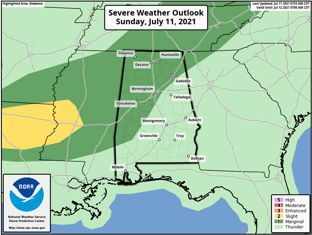
The marginal risk is their base severe weather threat category (level 1 out of 5). Tornadoes will not be a problem with no low-level shear. Hail won’t be an issue because of the warm atmosphere. But damaging winds will be a threat.
The storms should reach Tuscaloosa and Birmingham by 2-4 p.m. Here is the HRRR depiction of them at 3 p.m.
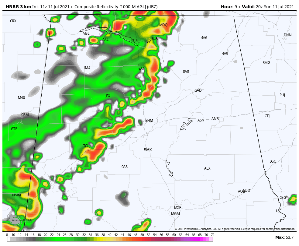
The storms should weaken slowly as they outrun their upper-level support. But don’t sleep on them until they pass.
Be ready as the line of storms approaches you. Just be in a safer structure as they pass in case trees or tree limbs fall.
Category: Alabama's Weather, ALL POSTS, Severe Weather
About the Author (Author Profile)
Bill Murray is the President of The Weather Factory. He is the site's official weather historian and a weekend forecaster. He also anchors the site's severe weather coverage. Bill Murray is the proud holder of National Weather Association Digital Seal #0001 @wxhistorianSubscribe
If you enjoyed this article, subscribe to receive more just like it.


