10 am Update: Heavy Rain & Tropical-Storm-Force Winds Now Affecting the Florida Keys
SUMMARY OF 10 AM CDT…1500 UTC…INFORMATION
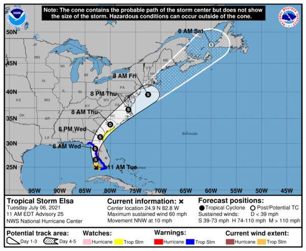
Location…24.9 N, 82.8 W
About 65 Mi…105 km WNW of Key West Florida
About 215 Mi…345 km S of Tampa Florida
Maximum Sustained Winds…60 mph…95 km/h
Present Movement…NNW or 340 degrees at 10 mph…17 km/h
Minimum Central Pressure…1007 mb…29.74 inches
WATCHES AND WARNINGS
A Storm Surge Warning is in effect for…
* West coast of Florida from Bonita Beach to the Aucilla River, including Tampa Bay
A Tropical Storm Warning is in effect for…
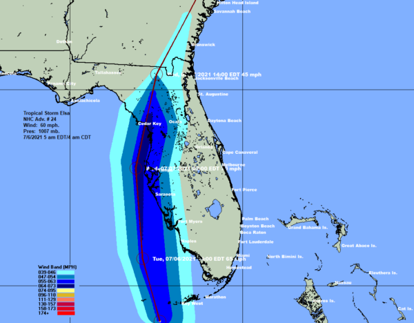
* The Florida Keys from Craig Key westward to the Dry Tortugas
* West coast of Florida from Flamingo northward to Ochlockonee River
A Hurricane Watch is in effect for…
* Egmont Key to the Steinhatchee River, Florida
A Storm Surge Watch is in effect for…
* West of the Aucilla River to the Ochlockonee River, Florida
A Tropical Storm Watch is in effect for…
* Mouth of St. Marys River to South Santee River, South Carolina
FORECAST DISCUSSION
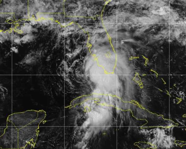
Elsa’s overall cloud pattern has changed little in organization since earlier today. There continues to be minimal shower and thunderstorm activity over the western semicircle of the circulation, with some bursting of deep convection near and east of the estimated center. A slightly-elevated observing site on Sand Key, near Key West Florida, recently reported a peak 1-minute wind of 49 kt with a gust to 56 kt. This supports the current intensity estimate of 50 kt. Recent WSR-88D Doppler velocities from the Key West radar suggest that the storm could be a little stronger than that. The Air Force Hurricane Hunter mission into the storm has been delayed due to bad weather at the Keesler base, but is rescheduled to investigate Elsa in a few hours. This flight should provide updated information on the intensity of the system.
Recently, the storm has been moving a little slower toward the north-northwest and the initial motion is about 340/9 kt. Elsa should move generally northward today and tonight between the western periphery of a subtropical ridge and an area of low pressure over the northwestern Gulf of Mexico. A gradual turn toward the north-northeast should occur on Wednesday as the system moves along the northwestern periphery of the ridge. Thereafter, the cyclone is expected to accelerate northeastward ahead of a trough over the eastern United States and eastern Canada. This will take the system across the southeastern United States within the next couple of days, near the coast of New England in about 3 days and near or over Atlantic Canada in 4 days or so. The official forecast is nearly the same as the previous one and, again, very close to the model consensus.
The environment over the eastern Gulf of Mexico is not ideal for strengthening, with moderate westerly shear and some dry mid-level air. However, upper-level divergence ahead of a trough over the east-central Gulf could result in some intensification of the system during the next 12-24 hours. The official forecast continues to show the cyclone nearing hurricane strength while it approaches the north Florida Gulf coast, but this is at the high end of the numerical intensity guidance.
KEY MESSAGES
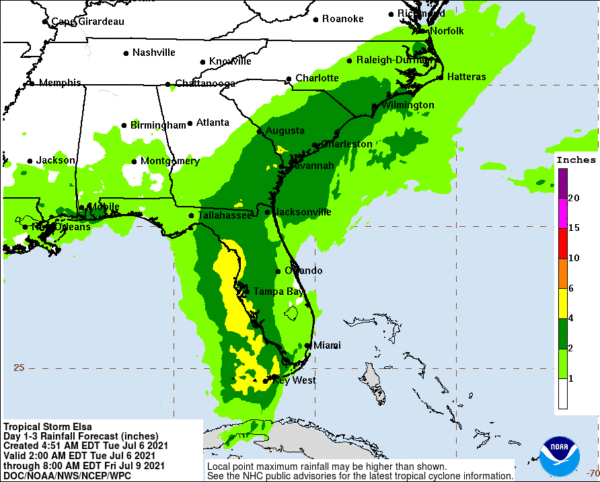
1. Heavy rain will impact Cuba today resulting in significant flooding and mudslides. As Elsa moves near or along the western Florida Peninsula through Wednesday, heavy rainfall may result in isolated flash, urban, and minor river flooding, with considerable flash and urban flooding possible in southwest and western portions of Florida. Mid to late week, heavy rainfall across coastal Georgia, South Carolina, North Carolina, and southeastern Virginia may result in isolated flash and urban flooding, with considerable flash and urban flooding possible across coastal Georgia and the Lowcountry of South Carolina.
2. There is a danger of life-threatening storm surge along portions of the west coast of Florida tonight and Wednesday, and a Storm Surge Warning is in effect for that area.
3. Hurricane conditions are possible tonight and early Wednesday along a portion of the west coast of Florida, where a Hurricane Watch is in effect. Tropical storm conditions are occurring across portions of the Florida Keys and are expected to spread northward along much of the west coast of the state through Wednesday morning, where a Tropical Storm Warning is in effect.
4. A Tropical Storm Watch is in effect for the Georgia coast and portions of the South Carolina coast, where tropical storm conditions are possible late Wednesday and early Thursday.
All images, forecasts, and documents are courtesy of their respective publishers.
Category: ALL POSTS, Severe Weather, Tropical


