Some Sun, Some Clouds, Some Showers as We Enter the Mid-Afternoon Hours
CENTRAL ALABAMA WEATHER
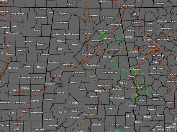
A few isolated to scattered showers have formed over the eastern half of Central Alabama, while much of the rest of the area is dry with partly to mostly sunny skies. Temperatures as of the 1 pm roundup were in the 80s across the area. Gadsden was the cool spot at 80 degrees. Troy was the hot spot at 88 degrees. Birmingham was sitting at 85 degrees.
A few scattered showers will be possible along and south of the I-59 corridor throughout the remainder of the afternoon hours today, while a few isolated showers will be possible north of that. The extreme northwestern corner of the area may stay dry, including Hamilton, Fayette, and Jasper. Skies will be partly to mostly cloudy, with highs hitting the mid-80s to the lower 90s. For tonight, a few isolated showers may linger over locations south of the I-59 corridor, while the rest of the area will be dry. Lows will be in the upper 60s to the lower 70s.
Shower and storm chances will be a little higher on your Sunday afternoon and into the early evening hours, with the higher chances south of I-22 and west of I-65. Skies will start off mostly clear, but will become partly cloudy as the heat builds throughout the day. Highs will be in the upper 80s to the lower 90s.
THE TROPICS
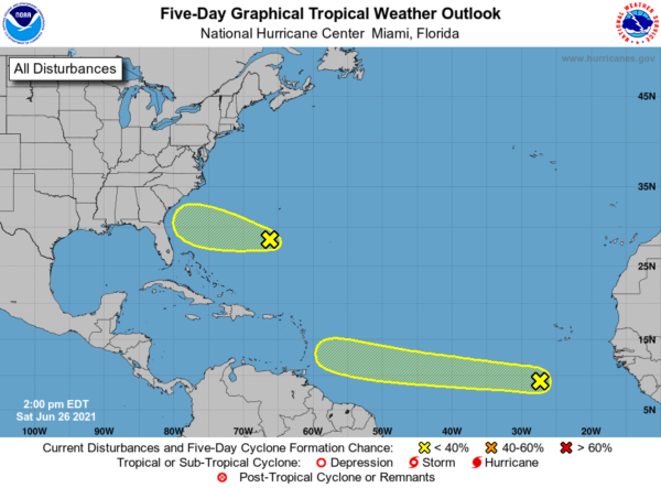
The National Hurricane Center has slightly increased the odds for Invest 95L to become better organized and potentially become a depression. Here is the latest on 95L… A tropical wave associated with a broad area of low pressure is located over the eastern tropical Atlantic Ocean about 400 miles south-southwest of the Cabo Verde Islands. Although shower and thunderstorm activity is currently disorganized, some slow development will be possible over the next several days while the disturbance moves generally westward at 15 to 20 mph. Depression/tropical storm formation chance through the next five days is low at 30 percent.
Another point of interest is a surface trough located a couple hundred miles south of Bermuda and is producing a broad area of disorganized showers and thunderstorms. Although surface pressures are currently high across the area, some additional slow development could occur while the system moves westward at 10 to 15 mph over the next few days. Depression/tropical storm formation chance through the next five days is low at 10 percent.
ON THIS DAY IN WEATHER HISTORY
1977… “The Human Lightning Conductor”, park ranger Roy C. Sullivan, was struck by lightning for the seventh time. He was first hit in 1942, then again in 1970, 1972, 1973 and 1976.
Category: Alabama's Weather, ALL POSTS, Tropical


