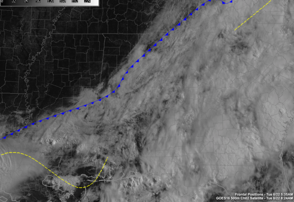
Here’s a Morning Look at Alabama’s Weather at 8:30 a.m.
Most of the showers are out of North and Alabama as we approach 8:30 on this Tuesday morning. There are a few over eastern Randolph, Chambers, and Russell Counties, but they will be into Georgia shortly. There is still quite a bit of rain in the Southeast Corner of the state around Dothan. Strong storms a removing through the middle and eastern Florida Panhandle from Destin to Apalachicola. The Alabama coast is now free of rain though.
Skies have cleared over the northwestern corner of the state in places like the Shoals, Moulton, Russellville, Hamilton, and Vernon. Everyone else is still pretty socked in for now, with just occasionally peeks of sun.
Our cold front is approaching I-59 at this hour. All of the precipitation outran it last night, limiting our severe chances.
Dewpoints are in the upper 50s and lower 60s across the Tennessee Valley. We are still sultry ahead of the front with dewpoints near 70F.
The clearing trend will continue as the front pushes to the southeast.
A few showers and storms will fire by early to mid-afternoon again for areas southeast of I-85. Some of those could be strong southeast of a line from Eufaula to Opp.
Highs today will be in the upper 70s north, to near 80 in the I-20 Corridor, and lower 80s down south.
It looks like we may get a respite from showers over North and Central Alabama for at least tomorrow and most likely Thursday before they return for Friday and the weekend.
Category: Alabama's Weather, ALL POSTS


