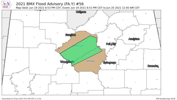
Exploding Storms Over West Alabama: Flood Advisory for Jefferson and Shelby Counties
This infrared satellite shows the explosion of thunderstorms over West Alabama over the past three hours.
The reds and oranges show really cold cloud tops that are high in the atmosphere.
Notice the anticyclonic flow aloft, helping to evacuate the rising air, and contributing to the storms’s intensification.
A serious situation is occurring in the Tuscaloosa/Northport area when numerous roads are flooded or impassable. The Tuscaloosa County EMA asks that residents stay home and do not drive.
A significant mudslide was reported in downtown Tuscaloosa near Jim and Nicks restaurant.
Dr. Laura Myers reports 8 inches of rain at her Tuscaloosa home.
Folks in the Birmingham area should also be alert. Steady heavy rain continues in the Birmingham area and flooding may be imminent in the normally poor drainage area.
A flood advisory was just issued for parts of Jefferson and Shelby Counties.
Seeing a good bit of lightning and thunder in the Birmingham area now indicating the convection that is occurring.
Category: Alabama's Weather, ALL POSTS, Pre-November 2010 Posts, Severe Weather, Tropical


