At 10 pm, PTC-3 Still Lacks All of the Pieces to be Considered a Tropical/Subtropical Storm
SUMMARY OF 1000 PM CDT…0300 UTC…INFORMATION
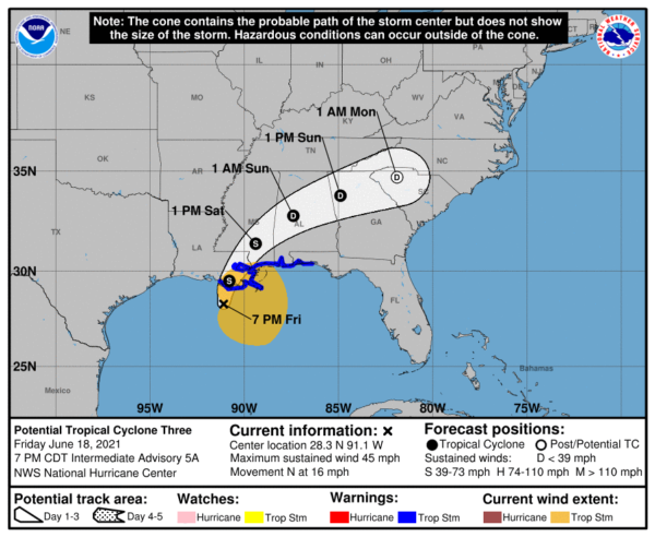
LOCATION…28.9N 90.9W
ABOUT 60 MI…95 KM SSE OF MORGAN CITY LOUISIANA
ABOUT 210 MI…335 KM SW OF MOBILE ALABAMA
MAXIMUM SUSTAINED WINDS…45 MPH…75 KM/H
PRESENT MOVEMENT…N OR 10 DEGREES AT 13 MPH…20 KM/H
MINIMUM CENTRAL PRESSURE…1007 MB…29.74 INCHES
SUMMARY OF WATCHES AND WARNINGS IN EFFECT
A Tropical Storm Warning is in effect for…
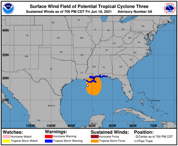
* East of Morgan City, Louisiana to the Okaloosa/Walton County line Florida.
* Lake Pontchartrain, Lake Maurepas, and Metropolitan New Orleans
A Tropical Storm Warning means that tropical storm conditions are expected somewhere within the warning area, in this case within the next 6-12 hours. Interests elsewhere along the northern Gulf Coast should monitor the progress of this system.
KEY MESSAGES
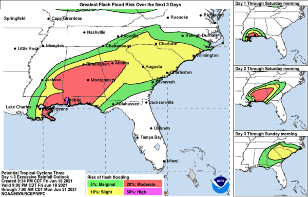
1. The system is expected to produce heavy rainfall and considerable flash, urban and small stream flooding, continuing through the weekend along the central Gulf Coast, with flood impacts spreading northeastward into the southern Appalachians and portions of the Southeast.
2. Tropical storm conditions are occurring along portions of the central Gulf Coast from east of Morgan City, Louisiana, to the Okaloosa/Walton County line, Florida, including New Orleans. These winds will spread inland and continue into Saturday.
FORECAST DISCUSSION
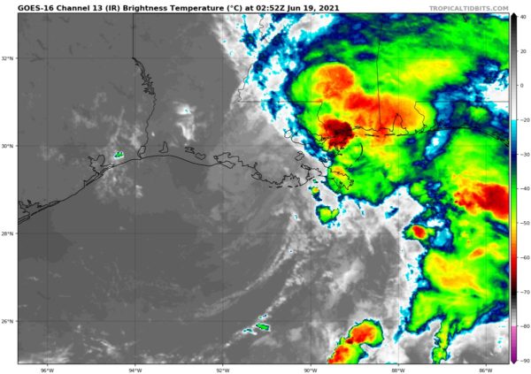
Satellite imagery indicates that the circulation associated with the broad low-pressure area over the northern Gulf of Mexico is slowly getting better defined, and several swirls of low-level clouds/vorticity centers were apparent in visible imagery just before dark. However, surface data and reports from an Air Force Reserve Hurricane Hunter aircraft show that the surface wind field is more like a trough elongated NNE-SSW from southeastern Louisiana into the Gulf. In addition, the convection associated with the system is mostly well to the northeast of the swirls. Based on this, the low will remain as a potential tropical cyclone, as it has not yet put all of the pieces together to be called a tropical or subtropical cyclone.
There is again little change to the track forecast reasoning. The initial motion is a little slower than before at 010/11. This general motion should continue until the system reaches the northern Gulf Coast in the next 6 h or so. After the system moves inland, a turn to the northeast and then east-northeast across the southeast U.S. is predicted when the cyclone becomes embedded in the westerlies on the north side of the subtropical ridge. The new forecast is a little faster and a little south of the previous forecast after 36 h based on the latest guidance, but other than that there are no significant changes.
Time is running out for the system to develop further before landfall. However, it should be noted that in this case, landfall will not instantly put an end to the chances of tropical or subtropical cyclone development, as much of the associated strong winds and convection will remain over water for at least 12 h. After that time, the system should be far enough inland to cause weakening to start. One note is that all of the global models except the GFS now forecast the low to survive for more than 72 h. The new intensity forecast will not change the dissipation time for now. However, if the 00Z global models continue this trend, subsequent advisories may need to show a longer life for the system.
Given the current and anticipated structure of this system, users should not focus on the exact track of the center, as rainfall and wind hazards are likely to extend well east of the center. Impacts along the northern Gulf coast will continue regardless of whether there is any additional development.
Category: Alabama's Weather, ALL POSTS, Severe Weather, Tropical


