Potential Impacts for Central Alabama from the Tropical System
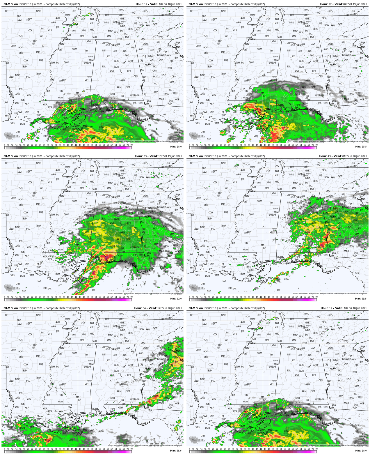
The latest full run of the high-resolution NAM shows rain and storms pushing up from the Gulf Coast throughout the late-night hours tonight and the pre-dawn hours on Saturday morning, and will continue through nearly the entire day before dry air starts to be pulled in and rain starts to taper off over the western and southwestern parts of the area on Saturday evening. The rain will continue to push east-northeastward and will eventually exit the area before sunrise on Sunday morning.
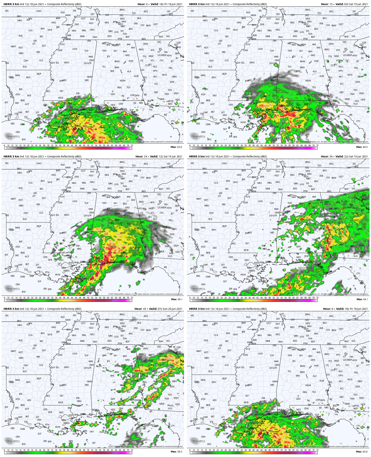
The 12z HRRR shows nearly the same scenario with rain and storms moving north-northeastward into the southern portions of the area by this evening and progressing through the area throughout the entire day on Saturday. This run also picks up on the dry areas in the southwestern parts of the circulation, with rain becoming more scattered on the western half of the storm. Eventually, much of the activity will be out of the area and over into Georgia by sunrise on Sunday morning, with the exception of a few scattered showers and storms.
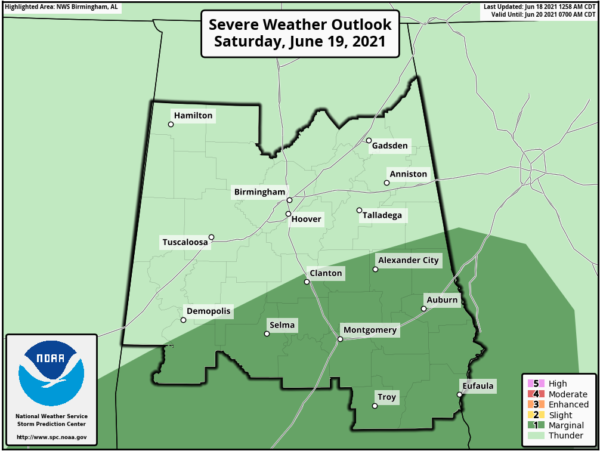
During the day on Saturday, there will be a marginal risk for severe storms for the southern and southeastern portions of the area mainly for the threat of a few brief spin-up tornadoes. The risk will mainly be for locations along and south of a line from Demopolis to Clanton to Roanoke.
While winds should not be a major issue across much of Central Alabama, some gusts up to or exceeding 30 mph will be possible mainly along and south of the US-80 and I-85 corridors in the southern parts of the area.
Most locations along and south of the I-20 corridor will see rainfall amounts in the 3 to 5-inch range with some localized amounts up to or exceeding 6 inches. Rainfall amounts from the tropical system will greatly drop off as you move north of I-20, mainly from 1 to 3 inches.
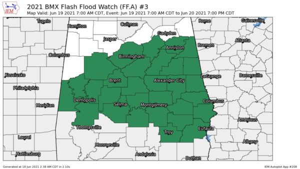
A Flash Flood Watch is up for much of Central Alabama starting at 7 am on Saturday morning and is set to expire at 7 pm Sunday night.
Just remember… this forecast is based on the current projected path of the system. If the forecast track shifts to the east or to the south, impacts will be less for the area. If the track shifts farther to the north or west, the impacts will be greater.
Stay weather aware throughout the weekend. We’ll have updates to keep you well-informed.
Category: Alabama's Weather, ALL POSTS, Severe Weather, Tropical


