9:30 Notes on Future Claudette
By Bill Murray and Scott Martin
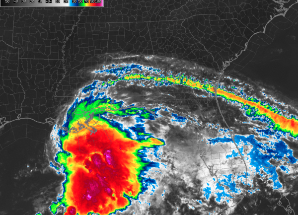
Thunderstorm activity has increased markedly over the past several hours in PTC #3 over the Central Gulf of Mexico.
An Air Force Reserve WC-130 plane is flying through the system now. They seem to have identified a couple of centers in the Central Gulf, about 275 miles south-southwest of New Orleans. The plane has not sampled any of the areas east of these centers, which would be where we would expect to find the strongest winds in that mass of thunderstorms.
It appears that the Hurricane Hunters just found a different center, so we may have the case where there are multiple centers located in a larger circulation, so the system is still not very organized.
But it is forecast to become a tropical storm soon, which will allow it to be named Claudette. Interestingly, Claudette is a name that has survived since it was added in 1979, the first year that male names were used in the Atlantic.
There will be a new advisory at 10 a.m., and it will be interesting to see if it is designated a tropical depression or tropical storm at that time.
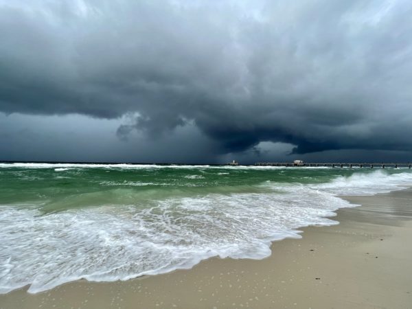
The outer edge of the system has pushed some dark clouds and heavy showers into the coastal areas from southeastern Louisiana through the Mississippi, Alabama, and extreme Northwest Florida coastlines. More steady rain is about 50 miles south of the Alabama coast and is moving into Southeast Louisiana. Rain will continue to increase across coastal sections during the day.
Double red flags are already flying at most beaches along the Alabama and Northwest Florida coast, indicating that no one is allowed in the water. This is important because rip currents will be a big risk through Tuesday along the Gulf Coast. On the Alabama coast, waves are expected to reach 7-10 feet through Saturday night before slowly diminishing. These types of systems tend to lead to unfortunate fatalities when anyone ventures into the dangerous and rough surf.
The center of the system will reach the Louisiana coast late tonight or early Saturday and turn northeast across southern Mississippi and track near or just south of I-59 on Saturday. The system will weaken quickly as far as winds go, but will be a prolific rain producer, particularly along and east of the center’s track.
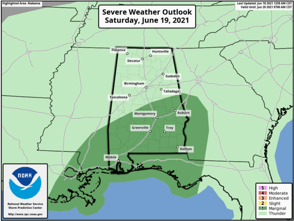
Tornadoes are possible later today and tonight from southeastern Louisiana to Northwest Florida including the Alabama coast. That threat will spread inland on Saturday to include the southern third of Alabama.
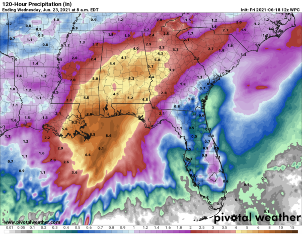
Rainfall forecasts indicate 6-8 inches of rain will fall in coastal sections from Southeast Louisiana through Northwest Florida. 4-6 inches is expected across Central and Southern Alabama generally along and south of I-20 with 2-4 inches over North Alabama. This could cause flooding and a Flash Flood Watch has been issued for most of Central and all of South Alabama.
Winds are picking up along the coast. Gulf Shores just measured a gust to 19 mph and winds are gusting to 26 mph at Keesler in Biloxi and 26 mph at KGPT, the Gulfport/Biloxi Regional Airport. On the Mississippi Canyon Platform south of the Louisiana Coast, winds were ESE at 28 mph gusting to 33 mph. That anemometer is at 102 feet, so you would expect it to show a higher wind velocity.
Mobilejust reported a wind gust to 30 mph.
A Tropical Storm Warning is in effect from Intracoastal City, Louisiana to the Okaloosa/Walton County line in Florida, east of Destin.
Storm surge is expected to reach 2-3 feet along a large stretch of the Gulf Coast from Vermillion Bay to Destin, including the Alabama coast and Mobile Bay.
We will have frequent updates throughout the day and weekend as this system impacts Alabama and the Gulf Coast.
Category: Alabama's Weather, ALL POSTS, Tropical


