Showers/Storms End Later Tonight; Beautiful Weekend Ahead
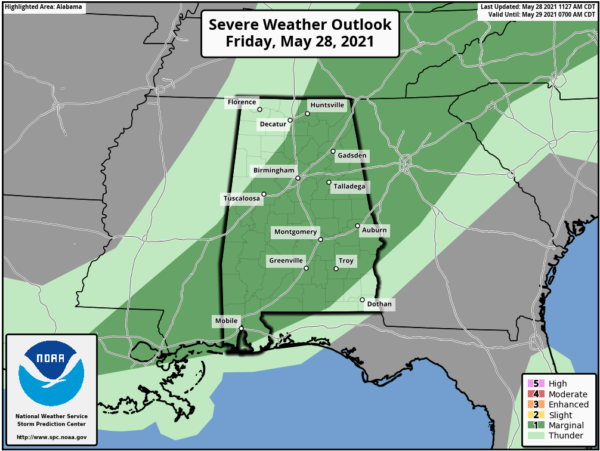
RADAR CHECK: A band of showers and thunderstorms is pushing through North and West Alabama this afternoon ahead of a cold front. Stronger storms in the line are producing heavy rain, frequent lightning, and gusty winds… but the storms so far are well below severe limits. SPC maintains a low end, “marginal risk” (level 1/5) ahead of the line through the evening hours, but the overall severe weather threat is low.
Storms end tonight as drier air rolls into the state following the front.
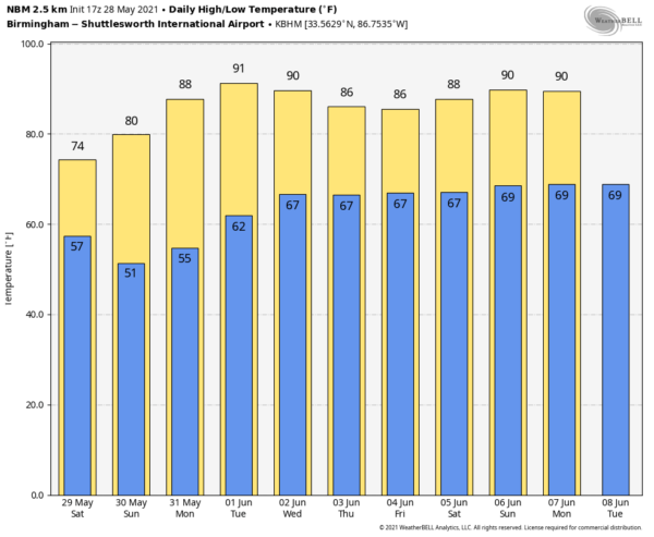
MEMORIAL DAY WEEKEND: We are forecasting sunny pleasant days and clear cool nights tomorrow through Monday. The high tomorrow and Sunday will be in the 70s over the northern half of the state, with mid 80s likely Monday. The coolest morning will come early Sunday when we will see some 40s over North/Central Alabama. Most places will see a low between 45 and 55 degrees. I checked the record book… the record low for May 30 at Birmingham is 41 in 1984; the observation in the city will probably stay about ten degrees above that level.
REST OF NEXT WEEK: Moisture begins to return Tuesday, and we will mention isolated showers by afternoon. Scattered showers and storms are possible Wednesday… becoming more numerous Thursday and Friday ahead of an another upper trough. Highs will be in the 80s… See the Weather Xtreme video for maps, graphics, and more details.
TROPICS: All remains quiet across the Atlantic basin, and tropical storm formation is not expected through early next week. The “official” beginning of the Atlantic basin season is Tuesday.
SEC BASEBALL TOURNAMENT: A passing shower or storm is likely at the Hoover Met this evening, but the weather will be dry and pleasant over the weekend. Expect lots of sunshine tomorrow and Sunday with highs in the 70s along with lower humidity levels.
ON THIS DATE IN 1863: The only known U.S. May hurricane landfall (“Hurricane Amanda”) came near Apalachicola, FL. At least 110 were killed. This once-forgotten Civil War-era hurricane was rediscovered by a 2013 study.
ON THIS DATE IN 1973: An F3 tornado moved east and struck the northern portion of Athens, Georgia. Destruction was massive near Athens, with losses estimated at ten million dollars. Damage from the storm included 545 homes and 17 businesses. Hundreds of large trees more than 100 years old were destroyed.
BEACH FORECAST: Click here to see the AlabamaWx Beach Forecast Center page.
WEATHER BRAINS: Don’t forget you can listen to our weekly 90 minute show anytime on your favorite podcast app. This is the show all about weather featuring many familiar voices, including our meteorologists here at ABC 33/40.
CONNECT: You can find me on all of the major social networks…
Look for my next Weather Xtreme video here by 6:00 a.m. Monday… enjoy the weekend!
Category: Alabama's Weather, ALL POSTS, Weather Xtreme Videos


