Some Clouds and Some Sun
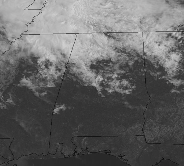
Some clouds today and a few rouge showers over North Alabama, thanks to northwest flow blowing them in from an area storms over the Mississippi Valley, we are seeing good supply of sunshine across the Alabama landscape. In fact, it is all sunshine for the southern half of the state today. After the chilly morning, temperatures this afternoon are surging into the mid and upper 70s with some low 80s in some spots. Tonight, expect a few passing clouds with lows in the mid 50s.
ACROSS THE USA: A strong system will produce a swath of impacts. Severe storms with large hail, damaging winds, and a couple of tornadoes will be possible in the south and central Plains. Heavy rain could cause flash flooding in the Mid-Mississippi Valley. Mountain snow will develop in the Rockies. Critical fire weather threats are expected across northern California and the Southwest.
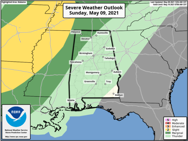
MOTHER’S DAY: Most of tomorrow will be amazing, like all the moms out there. We expect more sun than clouds most of the day. It will also be very warm and breezy with southerly winds of 15-25 mph a times, and that will help temperatures reach the mid and upper 80s across the state. Clouds increase late tomorrow, and we will bring showers and thunderstorms back to the forecast late tomorrow night ahead of a cold front.
This cold front will produce severe weather west of Alabama tomorrow, where the SPC has much of the Lower Mississippi Valley highlighted in a risk for severe weather, and that risk extends into northwest portions of the state late tomorrow tonight, after midnight, when a few strong storms will push into the state.
THE SUN HIT EARTH WITH A RADIO BURST: New sunspot AR2822 appeared today and promptly exploded, producing one of the strongest flares of young Solar Cycle 25. The M3.9-class explosion hurled a bright CME into space and hit Earth with a shortwave radio burst.
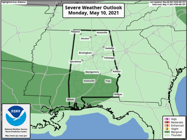
WET/STORMY WEEK: Monday morning starts off with heavy rainfall and some strong storms across the state, but through the day, as the front sinks south, the rain and storm threat shifts down into South Alabama, where a “marginal risk” (level 1/5) is in place.
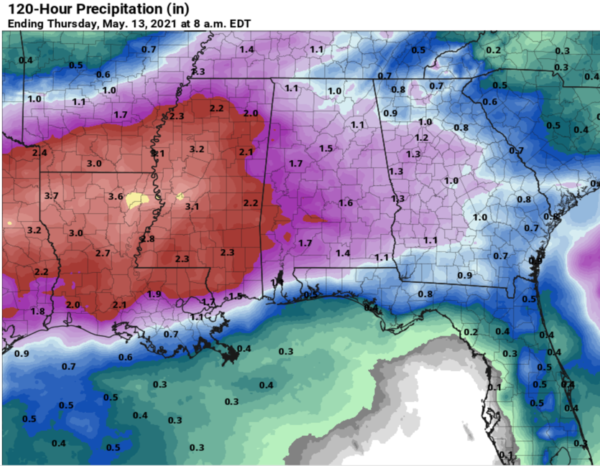
The front stalls across South Alabama for much of the week, and as we head through the week, pieces of energy will track along the front and keep rain and storms in the forecast each day through Thursday. There could be a few strong storms at times next week, but the overall severe weather threat remains low. We are forecasting soaking rains a times and rainfall totals between 1-3 inches are expected between Monday and Thursday, of course isolated higher amounts are likely.
Highs next week will be in the the low to mid 70s. Late Thursday, the front will push out of the area, and drier air returns for Friday with plenty of sunshine and highs in the upper 70s.
WEEKEND SNEAK PEEK: Next weekend looks to be very nice with dry conditions. Both Saturday and Sunday will feature more sun than clouds, with highs in the low 80s and lows in the 50s. Pretty standard for the middle of May in Alabama.
BEACH FORECAST CENTER: Get the latest weather and rip current forecasts for the beaches from Fort Morgan to Panama City on our Beach Forecast Center page. There, you can select the forecast of the region that you are interested in visiting.
WORLD TEMPERATURE EXTREMES: Over the last 24 hours, the highest observation outside the U.S. was 118.8F at Nuwasib, Kuwait. The lowest observation was -104.6F at Vostok, Antarctica.
CONTIGUOUS TEMPERATURE EXTREMES: Over the last 24 hours, the highest observation was 106F at Death Valley, CA. The lowest observation was 18F at Jarbidge, NV.
WEATHER ON THIS DATE IN 1784: A deadly hailstorm in South Carolina hit the town of Winnsborough. The hailstones, measuring as much as nine inches in circumference, killed several persons, and a great number of sheep, lambs and birds.
Category: Alabama's Weather, ALL POSTS


