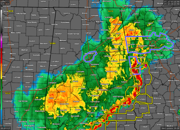
A Brief Check on Our Weather Situation Just After 8:00 pm
Conditions are greatly improving north and west of the I-59 corridor as the rain has come to an end or beginning to end. However, severe storms continue to move through the extreme southeastern parts of the area with damaging wind gusts and torrential rainfall. Severe T-Storm Warnings are up for Russell, Barbour, and parts of Pike counties. Behind the main line of storms, light to moderate rain continues to fall along and south of the I-59 corridor.
While most of the Flash Flood Warnings have expired or have been canceled, the Flash Flood Emergency for portions of Jefferson and Shelby counties continues until 8:15 pm.
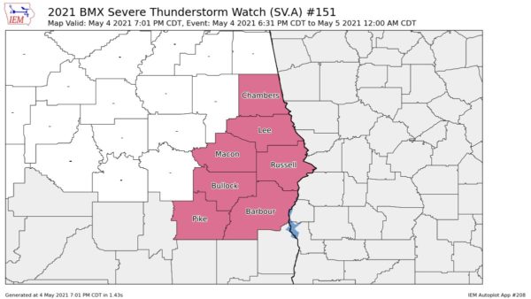
The Tornado Watch that was in effect for a good chunk of Central Alabama has been canceled, and a Severe Thunderstorm Watch continues for several counties in the southeastern portion of the area until midnight, but I’m pretty sure once those lead storms push off into Georgia that the watch will be canceled.
Here is a Tweet from ABC 3340’s Cynthia Gould showing water rescues taking place in Homewood…
20 residents of Homewood Apt complex rescued from floodwaters. Water receding a bit now. Many still trapped on top floors. @abc3340 @spann @TaylorSarallo pic.twitter.com/d9awf08GJJ
— Cynthia Gould (@cynthia3340) May 5, 2021
We cannot stress to you enough to please stay off the roadways unless you have to go to work or if it is an emergency. Most of the creeks around the Birmingham metropolitan area, as well as several throughout the area, are over their banks and may take until morning until they recede.
Category: Alabama's Weather, ALL POSTS, Severe Weather


