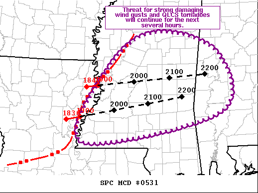
Latest Mesoscale Discussion: Damaging Wind Gusts & QLCS Tornadoes Possible Over the Next Several Hours
SUMMARY… Threat for strong damaging wind gusts, some over 70 mph, and embedded QLCS tornadoes will continue for the next several hours.
DISCUSSION… Recent radar imagery depicts a now well-organized convective line extending from north-central MS southwestward into eastern LA moving eastward at 45-50 kt. VAD profile from SHV sampled the rear-inflow jet well and the latest imagery from DGX is also sampling strong winds within this system. Potential exists for gusts over 70 mph at the surface.
Downstream air mass is very moist, with recent mesoanalysis estimating 100-mb mean mixing ratios over 16 g/kg and surface dewpoints in the low 70s. Earlier storms have reduced the mid-level lapse rates a bit, but forecast soundings and mesoanalysis still show steep lapse rates in the 800 to 600 mb layer. As such, overall buoyancy remains strong and there are no indications within the observations or environment of the line weakening.
Some potential for embedded QLCS tornadoes exist, particularly if the rear-inflow continues to mature and descend into the low-levels.
Category: Alabama's Weather, ALL POSTS, Severe Weather


