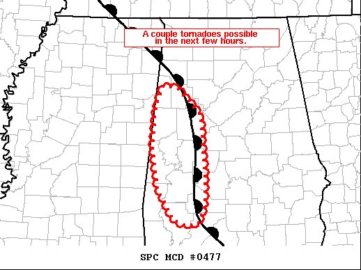
Tornado Watch Being Drawn Up… A Couple Tornadoes Possible Over the Next Few Hours
SUMMARY… Small supercells with a history of producing tornadoes may continue to pose a risk for brief tornadoes over the next couple of hours as a warm front lifts northeastward.
DISCUSSION…4 pm surface analysis showed a diffuse warm front across western Alabama and eastern Mississippi. Several small supercells have developed over the last within the deep surface moisture to the southwest of the warm front. Weak destabilization, MLCAPE (mid-level instability) around 500 J/kg, will likely continue to support weak convection for at least a couple of hours. Backed low-level winds along the front are enhancing low-level shear with 0-1km SRH (storm-relative helicity) of 150-200 m2/s2. Hi-res guidance and observational trends suggest a corridor of tornado potential will likely exists for at least a couple of hours as storms move to the northeast along the front. Coverage is expected to remain low, but a few tornadoes will be possible. Portions of west-central Alabama will be included in a Tornado Watch being coordinated across Mississippi.
Category: Alabama's Weather, ALL POSTS, Severe Weather


