Busy Night to Our West: New Tornado Watch into Mississippi
It has been a very active night to the west of Alabama tonight with active storms across Louisiana into southwestern Mississippi.
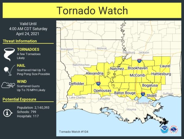
A new tornado watch has been issued for much of Central and southeastern Louisiana and southwestern Mississippi.
It goes until 4 a.m.
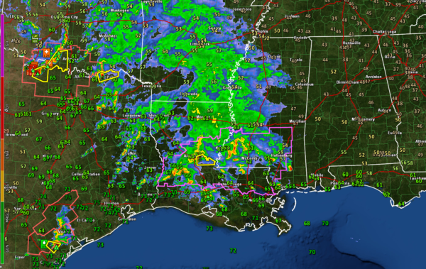
There are strong storms over Deep South Texas around Corpus Christi. Additional severe storms are over the Red River Valley of southern Oklahoma and North Texas.
Here is the radar at 9:25:
The first round of storms is being powered by a strong upper-level disturbance that will swing through our state early Saturday morning. These storms will push into western Alabama around 1-2 a.m. An area of heavy rain and storms will spread northeastward across Alabama between then and 8-9 a.m. It appears these storms will be energized by a strong low-level jet that will pump warmth and moisture northward rapidly late tonight.
Areas along and south of US-80 have the best chance of damaging winds, hail, and a couple of tornadoes.
Areas as far north as I-20 have a threat of some damaging winds and hail. But our storms in the I-20 Corridor will not be surface-based, which means they don’t have as high of a probability of being severe.
North of I-20 it should just be heavy rain and loud thunder.
Then the second wave of storms will form during the late morning and afternoon, and these storms will have a good chance of producing hail, perhaps even some large hail, and damaging winds. The tornado threat will be low. The best chance for severe weather tomorrow afternoon will be in the I-20 Corridor and areas to the south. There is a lesser risk over much of the rest of North Alabama.
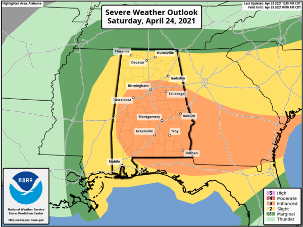
Here is the Day Two Outlook starting at 7 a.m. tomorrow:
The orange shaded area is Enhanced or level 3 out of 5. The yellow is the slight risk area, level 2 out of 5.
We will be watching the storms very carefully overnight and passing along vital warning and forecast information.
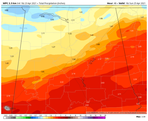
Rainfall should be fairly generous. Here is the latest WPC guidance through tomorrow evening:
The NWS MObile has issued a flash flood watch for much of Southwest Alabama. We don’t expect major flooding across North or Central Alabama although urban areas, like Tuscaloosa and Birmingham, could see some runoff issues with any heavier rain. That could cause local flooding.
Category: Alabama's Weather, ALL POSTS, Severe Weather


