Midday Nowcast: Dry Today, Rain and Storms Return Tonight
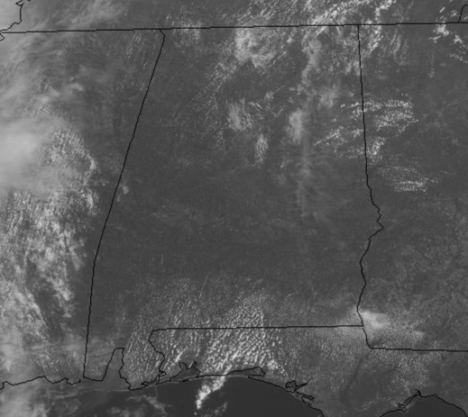
DRY, WARM WEDNESDAY: Today is another very nice spring day as temperatures climb into the upper 70s and lower 80s across the state this afternoon. Moisture levels are on the rise and clouds are on the increase the rest of today. It remains dry today, but an approaching cold front will bring a band of rain and thunderstorms to the state tonight and into Thursday and some of the storms could be strong, possibly severe.
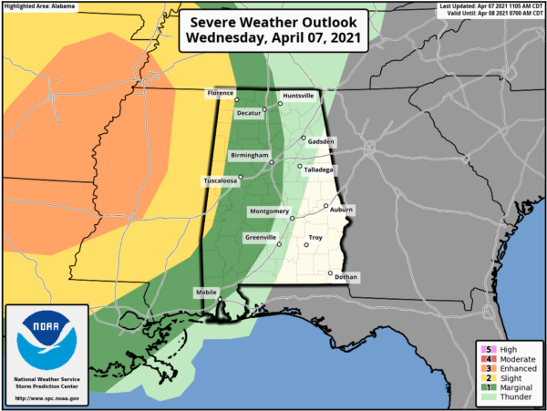
STORMS TONIGHT: The SPC maintains a “slight risk” (level 2/5) for a few counties near the Mississippi border, and a “marginal risk” (level 1/5) as far east as Huntsville, Verbena, and Atmore.
The storms will be weakening as they enter West Alabama, but they could still produce strong, gusty winds and some hail. Tornado chances are very low, but not zero, so we will need to mention the low chance of a brief, isolated tornado. The main window for the storms to roll through the state will come from 10PM the past midnight and into the morning hours tomorrow, but again, the storms will be weakening as the main dynamics pull well north of Alabama. While the severe weather threat late tonight and tomorrow morning isn’t “major”, you still need to pay attention to warnings if they are needed.
The storms will end by mid-morning tomorrow as a dry slot moves into the state, and much of tomorrow should be dry with more sun than clouds and very warm temperatures as highs are likely to climb into the lower 80s.
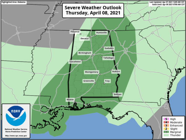
MORE RAIN/STORMS: Tomorrow night more rain and storms are expected to develop as a warm front starts to lift north out of the Gulf, bringing an unstable air mass back to Alabama, and occasional rain and storms will highlight the forecast by Friday afternoon.
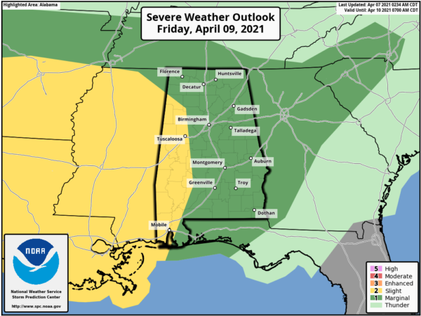
Where storms do form they could be strong, especially Friday afternoon when the air becomes very unstable and the SPC has defined a “slight risk” (level 2/5) of severe thunderstorms Friday west of a line from Hamilton to Tuscaloosa to Camden to Fairhope, with a “marginal risk” (level 1/5) for the rest of the state.
The main threats Friday will come from hail and strong winds. This unsettled weather should continue into Friday night and Saturday as well. The medium range models are hinting that an organized complex of storms will move into the state Saturday morning with potential for strong winds and a few isolated tornadoes, but there remains much uncertainty and this forecast will likely change over the next couple of days. The rain and storms should push down into South Alabama by the afternoon as drier air flows into the state, and for now Sunday looks mostly rain-free statewide with a partly to mostly sunny sky. Highs over the weekend will generally be in the mid and upper 70s.
Rainfall totals between now and Saturday afternoon could be in the 2-4 inch range across the state, so some isolated flooding is possible, but of course the main concern will continue to be numerous rivers across the state, which continue to run full from recent rains.
BEACH FORECAST CENTER: Get the latest weather and rip current forecasts for the beaches from Fort Morgan to Panama City on our Beach Forecast Center page. There, you can select the forecast of the region that you are interested in visiting.
WORLD TEMPERATURE EXTREMES: Over the last 24 hours, the highest observation outside the U.S. was 111.6F at Garoua, Cameroon. The lowest observation was -90.8F at Nico, Antarctica.
CONTIGUOUS TEMPERATURE EXTREMES: Over the last 24 hours, the highest observation was 103F at Rio Grande Village, TX. The lowest observation was 6F at Vernal, UT.
WEATHER ON THIS DATE IN 1857: A late season freeze brought snow to every state in the Union. Even as far south as Houston TX the mercury plunged to 21 degrees.
Category: Alabama's Weather, ALL POSTS


