The Line of Storms Continues a Slow Weakening Trend, but Marginal Severe Threat Continues
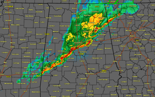
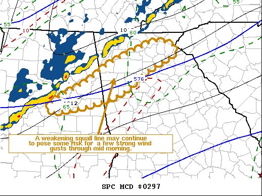
The line of rain and storms that is stretching across the and just south of the I-59 corridor as of 7:33 am continues in a trend of generalized weakening as cloud cover over the area out ahead of the line will limit and rise in instability, along with wind shear that will begin to weaken as well. Here is the text from the latest Mesoscale Discussion:
The severe weather threat for the current Severe Thunderstorm Watch continues.
SUMMARY… A weakening squall line may continue to pose some risk for localized potentially damaging wind gusts into mid-morning across the Piedmont of east central Alabama through northern Georgia, including portions of the Greater Atlanta metropolitan area. However, new severe weather watches are not currently anticipated.
DISCUSSION… Cloud cover appears likely to inhibit or slow pre-frontal and squall line boundary layer warming across the Piedmont early this morning, with model forecast soundings indicating some further moistening sufficient to contribute to only generally weak boundary-layer CAPE prior to the arrival of the approaching remnant squall line. While southwesterly flow remains as strong as 40-50 kt along this corridor just off the surface, this is forecast to slowly begin to weaken during the next few hours, which should also continue to gradually reduce the risk for severe wind gusts.
Category: Alabama's Weather, ALL POSTS, Severe Weather


