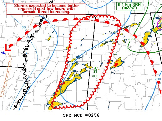
Latest Mesoscale Discussion: Storms Expected to Intensify with the Potential of Strong Tornadoes
SUMMARY… Storms are expected to intensify throughout the afternoon,
with several tornadic supercells possible including the threat of
strong tornadoes.
DISCUSSION… Areal coverage of thunderstorms has increased over the
past 2 hours across central and into eastern MS, where a very moist
and unstable air mass exists. Low-level winds have veered in the
wake of the warm advection storms to the northeast, which has
temporarily reduced SRH and made for straight hodographs. Indeed, a
few storms have become left movers recently with hail threat.
However, SRH will increase again over the next several hours as the
surface low develops to the northwest. This should result in an SRH
gradient over eastern MS and favorable parameters space for strong
tornadoes.
Current thinking is a few cells may consolidate into supercells out
of the larger area of storms. Additional storms are expected to form
along the front near the MS River as well. Strong southwest winds
aloft will bring all storms into an environment favorable for
tornadoes.
Category: Alabama's Weather, ALL POSTS, Severe Weather


