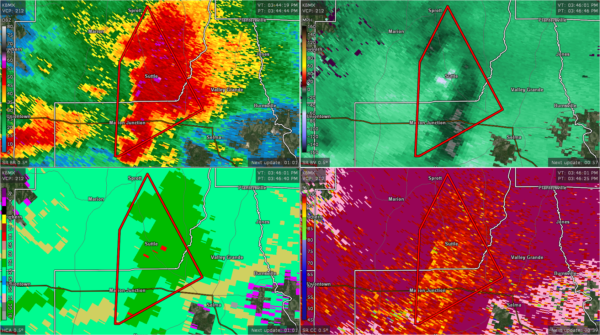
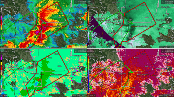
Tornado Warning Continued for Perry, & Dallas Co. Until 4:00 pm
…A TORNADO WARNING REMAINS IN EFFECT UNTIL 400 PM CDT FOR EAST
CENTRAL PERRY AND CENTRAL DALLAS COUNTIES…
At 345 PM CDT, a severe thunderstorm capable of producing a tornado
was located near Potter Station, or 8 miles west of Selma, moving
northeast at 35 mph.
HAZARD…Tornado.
SOURCE…Radar indicated rotation.
IMPACT…Flying debris will be dangerous to those caught without
shelter. Mobile homes will be damaged or destroyed. Damage
to roofs, windows, and vehicles will occur. Tree damage is
likely.
Locations impacted include…
Suttle and Radford.
PRECAUTIONARY/PREPAREDNESS ACTIONS…
TAKE COVER NOW! Move to a basement or an interior room on the lowest
floor of a sturdy building. Avoid windows. If you are outdoors, in a
mobile home, or in a vehicle, move to the closest substantial shelter
and protect yourself from flying debris.
…A TORNADO WARNING REMAINS IN EFFECT UNTIL 400 PM CDT FOR EAST
CENTRAL MARENGO…CENTRAL PERRY AND WEST CENTRAL DALLAS COUNTIES…
At 317 PM CDT, severe thunderstorms capable of producing tornadoes
were located along a line extending from near Vaiden to Central
Mills, moving northeast at 30 mph.
HAZARD…Tornado.
SOURCE…Radar indicated rotation.
IMPACT…Flying debris will be dangerous to those caught without
shelter. Mobile homes will be damaged or destroyed. Damage
to roofs, windows, and vehicles will occur. Tree damage is
likely.
Locations impacted include…
Marion, Uniontown, Thomaston, Bogue Chitto, Vaiden, Consul, Central
Mills, Marion Junction, Perry County Correctional Center, Judson
College, Radford, Carleys, Suttle, Sprott and Vaiden Field Airport.
PRECAUTIONARY/PREPAREDNESS ACTIONS…
TAKE COVER NOW! Move to a basement or an interior room on the lowest
floor of a sturdy building. Avoid windows. If you are outdoors, in a
mobile home, or in a vehicle, move to the closest substantial shelter
and protect yourself from flying debris.
Category: Alabama's Weather, ALL POSTS, Severe Weather


