Marginal Threat for Severe Storms Will Continue Through the Late-Night & Overnight Hours
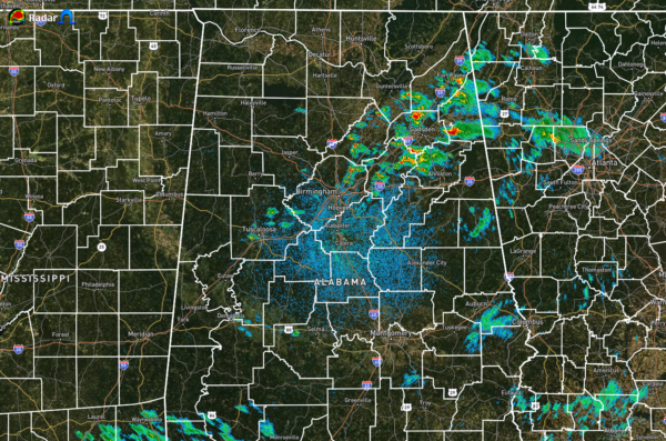
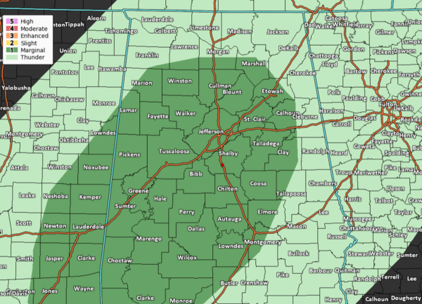
As of 10:15 pm, we still have a Marginal Risk for severe storms as the atmosphere has calmed down as much as we thought it would throughout the night so far. We continue to have a decent amount of instability over the southern half of North/Central Alabama, with values reaching the 500-1300 J/kg range. That is plenty of fuel to fire off any storms and keep them going for a little while. We continue to have a decent amount of wind shear in place, up to around 50 to 65 knots from south to north. That is sufficient enough to storms to become organized and persist for a while. We now have helicity values in the range where we could start seeing the updrafts start to rotate and a tornado could form. The Significant Tornado Parameter is showing values of 1 to 2 over a good chunk of Central Alabama, so this is also showing that a tornado may be possible.
That is the reason why the Storm Prediction Center is continuing the Level 1 Marginal Risk for severe storms up through the remainder of the night and into the early morning hours on Tuesday.
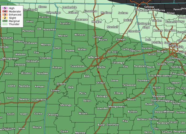
We also have to remember that starting at 7:00 am on Tuesday morning, all of Central Alabama goes under a Marginal Risk for severe storms, along with the south and southwestern parts of North Alabama (including Russellville, Moulton, Falkville, Cullman, and Boaz). We’ll have to stay weather aware from now through the early morning hours on Thursday morning. I’ll be taking donations for coffee (just kidding). Here is the latest from the NWS offices in Birmingham and Huntsville…
NWS Birmingham’s Hazardous Weather Outlook:
For tonight until 7 am Tuesday:
A couple severe storms may occur during the overnight and early morning hours. The primary hazards are large hail and damaging winds. A brief tornado cannot be ruled out.
Tuesday 7 am to 10 pm:
Severe thunderstorms are possible again through 10 pm Tuesday for much of Central Alabama. Damaging winds and large hail are the main threats. A brief tornado cannot be ruled out.
NWS Huntsville’s Hazardous Weather Outlook:
For tonight until 7 am Tuesday:
A few thunderstorms will be possible this evening and overnight, as a slow-moving frontal boundary stalls across the region. However, at this time, the greatest probability for storms appears to be to the south of a line extending from Moulton to Huntsville and Bridgeport. Brief strong wind gusts of 30 to 40 MPH and frequent cloud to ground lightning will be the main threats with the strongest cells.
Tuesday 7 am to midnight:
The stalled frontal boundary will move very little during the day tomorrow, with the threat for a few thunderstorms continuing across mainly Cullman, Marshall and Dekalb counties.
Category: Alabama's Weather, ALL POSTS, Severe Weather


