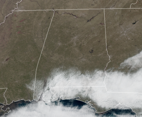
Midday Nowcast: Sunny and Bright Wednesday
A completely different weather day across the state today compared to yesterday as a drier air mass is returning to the state. We are seeing tons of sunshine from one end of the state to other, with the exception of some clouds across far South Alabama and the Gulf Coast, but even there, the sky will become sunny this afternoon. It is a warmer day as well with temperatures surging into the lower and mid 60s by the end of the day. Tonight will be a clear and cold one with lows falling back into the 30s.
TOMORROW/FRIDAY: Tomorrow will be a sunny day with highs ranging from the mid 60 to mid 70s across the state. The weather stays dry during the day Friday, but clouds will increase afternoon ahead of a disturbance that could squeeze out some light rain across portions of Alabama Friday night. Highs Friday will be in the mid and upper 60s.
BEACH FORECAST CENTER: Get the latest weather and rip current forecasts for the beaches from Fort Morgan to Panama City on our Beach Forecast Center page. There, you can select the forecast of the region that you are interested in visiting.
WORLD TEMPERATURE EXTREMES: Over the last 24 hours, the highest observation outside the U.S. was 108.5F at Sapu, Gambia. The lowest observation was -74.0F at Vostok, Antarctica.
CONTIGUOUS TEMPERATURE EXTREMES: Over the last 24 hours, the highest observation was 90F at Palm Beach Gardens and Imomokalee, FL. The lowest observation was -19F at Peter Sinks, NH.
WEATHER ON THIS DATE IN 2003: It was a day of temperature extremes. Miami reached a high temperature of 90 degrees, the earliest observed 90 degree temperature since March 5, 1964. Meanwhile Marquette, MI, dropped to 30 degrees below zero, the lowest temperature ever recorded in the city in March.
Category: Alabama's Weather, ALL POSTS


