9 a.m. Update: Icing Continues Across West and North Alabama
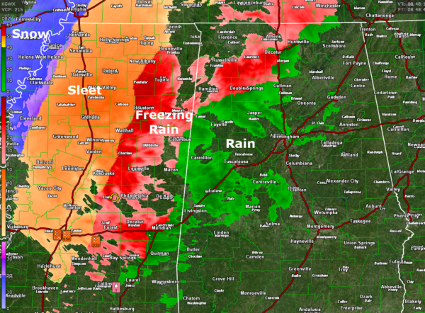
Rain and freezing rain with some sleet continue across northern and western Alabama this morning. Here is the radar:
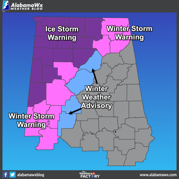
Conditions are dangerous in the ice storm warning area, with ice-covered bridges and overpasses across parts of northern Lamar, Marion, Winston, Franklin, Lawrence, and Morgan Counties.
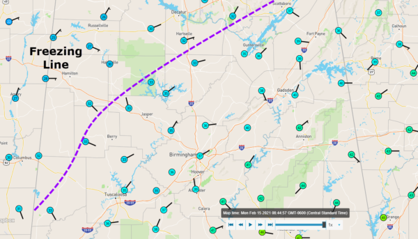
Here is the approximate freezing line using a Wundermap from Weather Underground of personal weather stations:
Areas northwest of the dashed line are at or below freezing. Any precipitation that is falling is either freezing rain or sleet, with some snow. But roads to the northwest of the line are very hazardous.
A huge area of freezing rain and sleet is moving across Mississippi at this hour. Freezing rain will continue to accumulate in the Ice Storm Warning and Winter Storm Warnings areas across much of western and North Alabama into the afternoon.
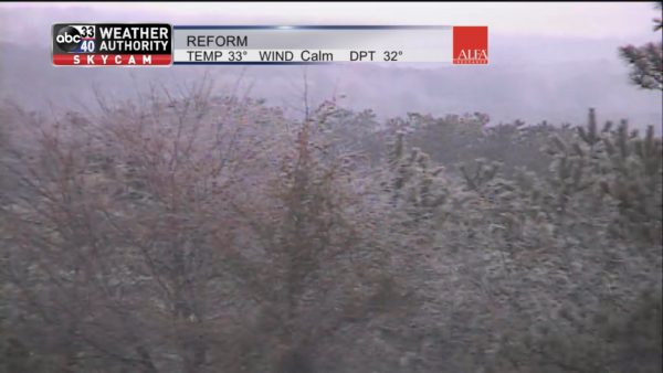
Ice is accumulating on trees near our Skycam at Reform in Pickens County with a temperature of 33F.
In the Winter Weather Advisory area, the rain will change over to freezing rain or sleet late this afternoon and evening. in the Birmingham area, that changeover should occur around 6 p.m. Right now, there are no problems, with temperatures in the upper 30s to lower 40s across the Birmingham Metro area now.
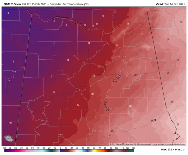
Bitter cold temperatures will follow the precipitation with temperatures across the area tonight looking like this:
Wind chills will be as cold as -5F!
Heavy sleet accumulations over much of Louisiana into the Mississippi Delta. 1.3 inches of sleet was just reported at WAPT in Jackson MS.
Ice accumulations will even reach the western suburbs of New Orleans, which would be rollicking in a normal year with Fat Tuesday coming tomorrow.
Category: Alabama's Weather, ALL POSTS, Winter Weather


