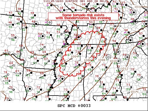
A Tornado Watch May Be Issued for the Northwestern Portions of North/Central Alabama in a Couple of Hours
SUMMARY…Scattered strong thunderstorms are expected across the Mid-South into Middle TN this evening. Some risk for tornadoes may necessitate a watch in the next couple of hours.
DISCUSSION…Strong mid-level short-wave trough is ejecting across the central Plains this evening. The more appreciable height falls will spread across the Mid-MS into the OH Valley region. Along the southern fringe of this stronger large-scale forcing, robust convection has recently developed across portions of western TN where surface dew points have risen into the mid-60s with surface temperatures in the lower 70s. This activity should spread east-northeast along a corridor that is destabilizing just south of a well-defined warm front. Ample shear/buoyancy exists for supercells (possibly tornadic supercell ongoing over Fayette County TN) and there is increasing concern/confidence that other organized longer-lived storms may develop.
Farther south along the Pacific front, showers are gradually deepening from northwest MS into northeast LA. Some lightning is noted with the stronger updrafts but activity has struggled to organize. It’s not entirely clear how many organized supercells can/will develop along this zone, but shear/buoyancy do favor some tornado threat. A tornado watch may be warranted for this activity in the next couple of hours.
Category: Alabama's Weather, ALL POSTS, Severe Weather


