A Quick Weather Update Before 7:00 am
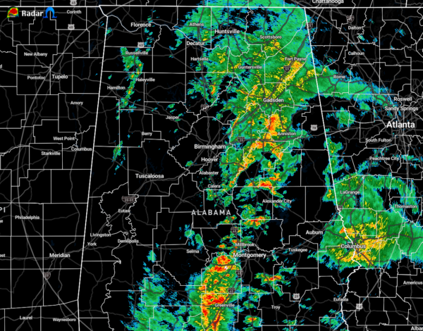
A broken line of showers and thunderstorms continues to move across the eastern half of North/Central Alabama as showers along the cold front are dissipating in intensity. The cold front is currently located over the extreme western parts of the area near the Mississippi state line, and there is no rain falling behind the front.
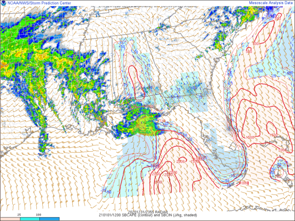
There is a small tongue of instability right along the I-65 corridor stretching south of Calera down to Fort Deposit and south. This may be where the best opportunity for stronger to severe storms to form later this morning, especially with temperatures already in the upper 60s to 70 degrees and dewpoints in the mid to upper 60s. Wind shear continues to be in the 50-60 knot range, which is more than enough to get storms started. There is plenty of helicity available as well, so we’ll have to continue to watch locations south of a line from Rockford to LaFayette and east of the I-65 corridor as these storms move through for the potential of rotating updrafts. STP values of 1.0 and slightly greater are currently located over that tongue of instability. So there is the potential for a brief tornado.
The main active line of rain and storms will be out of the eastern parts of the area by 10:00 am and out of the southeastern parts by midday. Behind the cold front, skies will begin to clear somewhat and we will see some sunshine before sunset hits this evening. Afternoon highs are still projected to reach the upper 60s to the mid-70s.
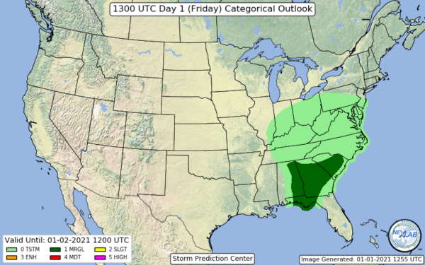
The latest Day 1 Severe Weather Outlook just came out as I was typing this post and they have removed the western 2/3rds of North/Central Alabama from the Marginal Risk, keeping it defined for the eastern-third of the area.
Category: Alabama's Weather, ALL POSTS, Severe Weather


