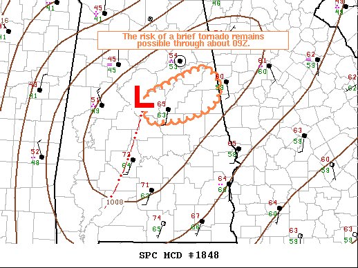
The Risk for a Brief Spin-up Tornado Continues for the Next 60-120 Minutes
SUMMARY
The risk for a brief QLCS tornado might persist for another hour or two in a narrow corridor across east-central AL.
DISCUSSION
A low-topped narrow squall line of showers produced a TDS around 0700Z in southern Jefferson County. This portion of the squall line appears to be co-located with the surface cyclone that is expected to continue east into northern GA through daybreak. A confined plume of 63-64 F surface dew points just ahead of the cyclone appears to be sufficient to yield scant surface-based buoyancy with MLCAPE of 100-200 J/kg per 06Z RAP soundings. In the presence of extreme low-level SRH (0-1 km above 500 m2/s2), the risk for another brief tornado is not entirely negligible where surface winds can remain southerly in a narrow corridor ahead of the cyclone. Surface winds that are more south-southwesterly across the warm sector will minimize the risk farther south.
Category: Alabama's Weather, ALL POSTS, Severe Weather


