A Brief Check on Our Weather Situation Just After 12:30 am
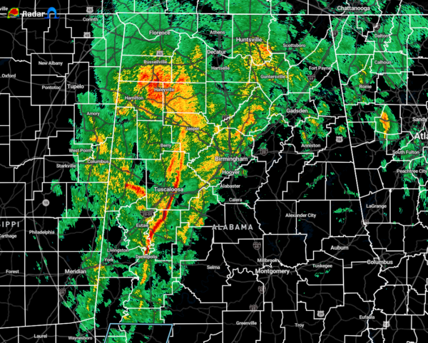
As of 12:24 am, the line of rain and storms that we have been tracking trough Mississippi has now made it into the western and west-central parts of Central Alabama. The good news is that there are no lightning strikes showing up on radar at the moment, so that means that instability is remaining very low.
The low has broadened out somewhat and is centered over the middle of Central Alabama. Winds have picked up across the area with locations ahead of the line out of the south gusting as high as 26 MPH at the Shelby County Airport. Behind the line, winds have shifted to out of the northeast gusting as high as 24 MPH.
The most intense rain band stretches from Jasper and Parrish down to just west of Brookwood to Demopolis. All the activity is pushing off to the northeast around 50 MPH.
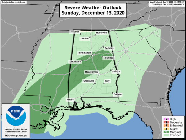
The SPC is continuing to show the same locations in a Marginal Risk for severe storms through the rest of the overnight hours until 6:00 am. I think the main threat from any of the storms south of the surface low will be from isolated strong to damaging wind gusts up to 60 MPH. We still have plenty of shear and helicity in place, but that is mainly displaced north of the low. There are still decent enough values to support a strong to severe storm or two, but with the lack of instability, it will be hard to get a storm to become strong.
We’ll keep on watching the storms for you.
Category: Alabama's Weather, ALL POSTS, Severe Weather


