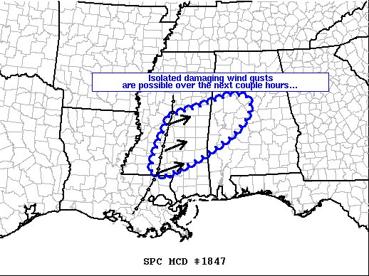
While Isolated Damaging Wind Gusts Are Possible, Severe Watch Not Likely to Be Issued Tonight
SUMMARY
An isolated damaging-wind threat is possible with a line of storms quickly moving through the discussion area.
DISCUSSION
The latest radar mosaic/objective analyses indicate a relatively narrow band of strongly forced convection near/just east of the I-55 corridor in Mississippi. These storms were aided by strong forcing aloft associated with an advancing mid-level wave near the ArkLaTex and marginally unstable near-surface parcels. Strong wind fields/shear and downward momentum processes may foster a few damaging wind gusts with this line as it sweeps quickly east-northeastward across the discussion area over the next few hours. A brief uptick in intensity is possible if slightly more buoyant area (characterized by mid 60s F dewpoints currently across southeastern Mississippi/southern Alabama) can migrate northward and interact with the line. A WW issuance is not anticipated due to the isolated nature of the threat.
Category: Alabama's Weather, ALL POSTS, Severe Weather


