Chilly Tonight; Warmer Days Ahead
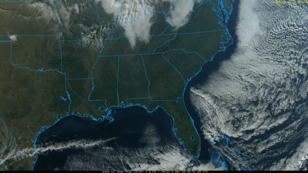
NOTHING BUT SUNSHINE: Not a cloud in the sky over Alabama this afternoon; temperatures are mostly in the low to mid 50s. Tonight will be chilly again, with lows generally between 30 and 35. Colder spots could dip into the upper 20s.
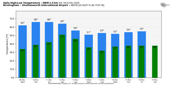
REST OF THE WEEK: Our weather will stay dry through Friday with sunny days, fair nights, and a warming trend. The high tomorrow will be in the low 60s, followed by mid 60s Thursday, and upper 60s Friday. A few spots over West and South Alabama could touch 70 degrees Friday afternoon. Clouds will increase Friday night.
THE ALABAMA WEEKEND: A cold front will push a band of rain and thunderstorms into the state Saturday. New model guidance continues to show very little surface based instability, and with the main dynamic forcing to the north severe storms are not expected. Rain amounts of 1/2 inch are less are expected, and the rain will end Saturday evening. Then look for gradual clearing Sunday; the day will be breezy and colder with a high in the low to mid 50s.
NEXT WEEK: Monday and Tuesday will be cool and dry; a disturbance will bring a chance of some light rain Wednesday, followed by drier air Thursday and Friday. Highs will be mostly in the 50s through the week… See the Weather Xtreme video for maps, graphics, and more details.
FOOTBALL WEATHER: Saturday, Alabama will take on Arkansas in Fayetteville (11:00a CT kickoff)… the weather looks dry but cold. The sky will be mostly cloudy with temperatures holding in the low to mid 40s during the game. Then, Saturday evening, Auburn travels to Starkville to taken on Mississippi State (6:30p CT kickoff). While rain is likely during the day in East Mississippi, there is a good chance the rain will be over by game time. Temperatures will fall from near 55 at kickoff, into the 40s by the second half.
ON THIS DATE IN 2017: Significant snow fell across a large portion of Central Alabama. Within the main corridor of snow, totals of 4 to 8 inches were common, with a few swaths of 8 to 12 inches. A few reports exceeding 12 inches were received from Clay into Cleburne Counties: one 15 inch report in Delta (Clay Co.), and two 13 inch reports (Cleburne Co.). While public reports are considered unofficial, values were fairly consistent and tend to indicate this event was a top-tier ranking snowstorm for some locations in East Alabama. Birmingham officially recorded 4 inches of snow, making it the 3rd snowiest December on record. A few flakes were seen in far South Alabama as well; even Mobile and Baldwin counties had some snow.
BEACH FORECAST: Click here to see the AlabamaWx Beach Forecast Center page.
WEATHER BRAINS: Don’t forget you can listen to our weekly 90 minute show anytime on your favorite podcast app. This is the show all about weather featuring many familiar voices, including our meteorologists here at ABC 33/40.
CONNECT: You can find me on all of the major social networks…
Look for the next Weather Xtreme video here by 7:00 a.m. tomorrow…
Category: Alabama's Weather, ALL POSTS, Weather Xtreme Videos


