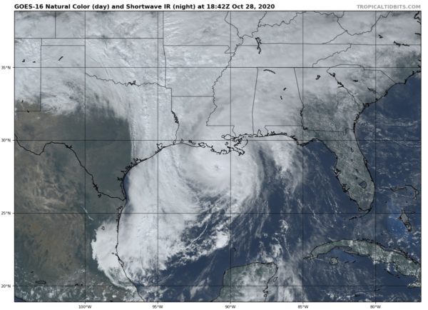
At 2:00 pm, Zeta Continues to Strengthen; Eyewall Within an Hour or Two of Reaching the Coast
Recent data from an Air Force Reserve Hurricane Hunter aircraft indicate that Zeta’s maximum winds have increased to 105 mph (165 km), with higher gusts, and the central pressure has fallen to 973 MB. It now appears likely that Zeta will maintain category 2 intensity on the Saffir-Simpson Hurricane Wind Scale until its initial landfall in southeast Louisiana later this afternoon.
Sustained tropical-storm-force winds are now spreading onshore the southeastern coast of Louisiana. A sustained wind of 45 mph (72 km/h) was recently reported at Caillou Bay, Louisiana.
SUMMARY OF 200 PM CDT…1900 UTC…INFORMATION
———————————————-
LOCATION…28.3N 90.9W
ABOUT 85 MI…135 KM SW OF GRAND ISLE LOUISIANA
ABOUT 125 MI…205 KM SSW OF NEW ORLEANS LOUISIANA
MAXIMUM SUSTAINED WINDS…105 MPH…165 KM/H
PRESENT MOVEMENT…NNE OR 25 DEGREES AT 21 MPH…33 KM/H
MINIMUM CENTRAL PRESSURE…973 MB…28.73 INCHES
Category: Alabama's Weather, ALL POSTS, Severe Weather, Tropical


