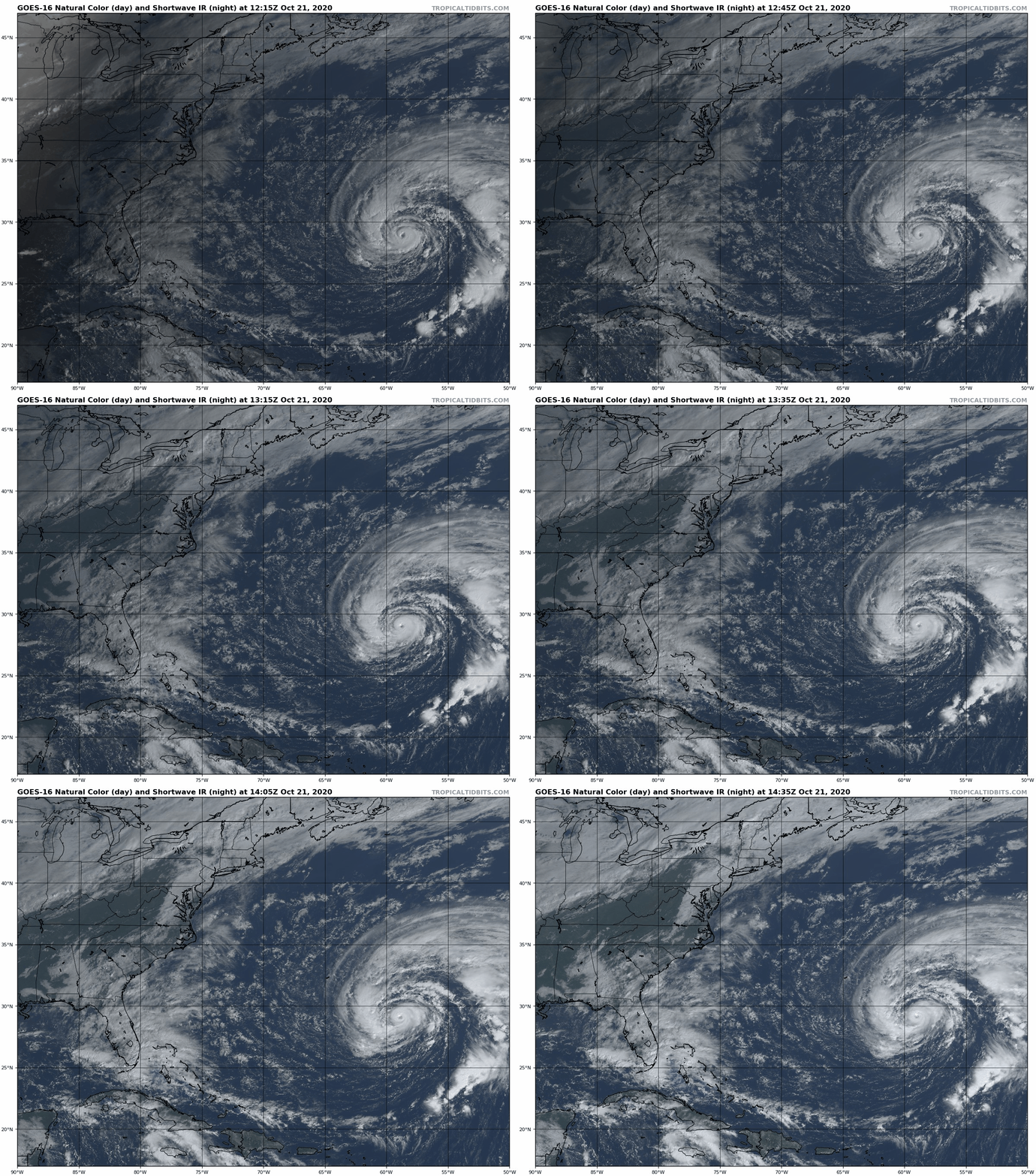
Hurricane Epsilon A Little Stronger; Tropical Storm Warnings Issued for Bermuda
Hurricane Epsilon has strengthened quite a bit overnight and this morning and has top winds of 90 mph.
It is located about 400 miles ESE of Bermuda.
It has turned more westward in response to high pressure to its north, but will resume a northwest track before curving to the north and northeast tomorrow through Saturday.
The hurricane will pass about 200 miles east of Bermuda Thursday evening. Winds on the island will reach 30-35 mph with gusts to above 40 mph.
Here is the forecast from the Bermuda Weather Service:
Headline – Rather bright today, but a Tropical Storm Warning is in effect.
Public Synopsis – A Tropical Storm Warning is in effect as Hurricane Epsilon several hundred miles to our southeast moves northwestward to be east of the Island tomorrow night into early Friday. Intensifying showers with tropical storm force wind will intermittently occur into Friday then ease thereafter as Epsilon exits to our north. Hazardous seas and surf can be expected over the next several days.
Today – Hazy sunshine, cloud thickens by dusk… Winds northeasterly strong to gale force… High near 27°C/81°F. Clear sky UV Index forecast – 6 or high.
Tonight – Mostly cloudy, developing showers, slight chance thunder… Winds northeasterly strong to gale force, with stronger gusts in and around showers… Low near 23°C/74°F.
Thursday – Sunny breaks, dry afternoon, showery evening and night… Winds north-northeasterly strong to gale force, increasing northerly strong to gale force (at times) evening onward with stronger gusts in and around showers… High near 27°C/80°F, low near 23°C/73°F. Clear sky UV Index forecast – 6 or high.
Friday – Sunny breaks, showers, slight chance thunder, easing night… Winds northerly strong to gale force, backing northwesterly strong overnight with stronger gusts in and around showers, easing towards dawn… High near 26°C/79°F, low near 22°C/72°F.
Saturday – Sunny periods developing after a few early showers… Winds west-northwesterly moderate to strong, easing moderate in the afternoon, further easing light to moderate overnight… High near 26°C/79°F, low near 22°C/71°F.
BULLETIN
Hurricane Epsilon Advisory Number 10
NWS National Hurricane Center Miami FL AL272020
1100 AM AST Wed Oct 21 2020
…EPSILON A LITTLE STRONGER…
…TROPICAL STORM WARNING ISSUED FOR BERMUDA…
SUMMARY OF 1100 AM AST…1500 UTC…INFORMATION
———————————————–
LOCATION…29.1N 59.1W
ABOUT 405 MI…650 KM ESE OF BERMUDA
MAXIMUM SUSTAINED WINDS…90 MPH…150 KM/H
PRESENT MOVEMENT…WNW OR 285 DEGREES AT 12 MPH…19 KM/H
MINIMUM CENTRAL PRESSURE…972 MB…28.71 INCHES
WATCHES AND WARNINGS
——————–
CHANGES WITH THIS ADVISORY:
The Bermuda Weather Service has issued a Tropical Storm Warning for
Bermuda.
SUMMARY OF WATCHES AND WARNINGS IN EFFECT:
A Tropical Storm Warning is in effect for…
* Bermuda
A Tropical Storm Warning means that tropical storm conditions are
expected somewhere within the warning area within 36 hours.
For storm information specific to your area, please monitor
products issued by your national meteorological service.
DISCUSSION AND OUTLOOK
———————-
At 1100 AM AST (1500 UTC), the center of Hurricane Epsilon was
located near latitude 29.1 North, longitude 59.1 West. Epsilon is
moving toward the west-northwest near 12 mph (19 km/h). A
west-northwestward motion at a slower forward speed is expected
today. A turn toward the northwest is expected tonight, followed by
a turn toward the north by Thursday night. On the forecast track,
the center of Epsilon is forecast to make its closest approach to
Bermuda Thursday afternoon or evening.
Maximum sustained winds have increased to near 90 mph (150 km/h)
with higher gusts. Some additional strengthening is possible today,
followed by little change in strength into the weekend.
Hurricane-force winds extend outward up to 25 miles (35 km) from the
center and tropical-storm-force winds extend outward up to 435 miles
(705 km) mainly to the north of the center.
The estimated minimum central pressure is 972 mb (28.71 inches).
HAZARDS AFFECTING LAND
———————-
WIND: Tropical storm conditions are expected on Bermuda beginning
later today and continuing intermittently through late Thursday.
SURF: Large swells generated by Epsilon are affecting Bermuda, the
Bahamas, the Greater Antilles, and the Leeward Islands, and are
expected to reach portions of the east coast of the United States
and Atlantic Canada during the next couple of days. These swells
are likely to cause life-threatening surf and rip current
conditions. Please consult products from your local weather office.
NEXT ADVISORY
————-
Next intermediate advisory at 200 PM AST.
Next complete advisory at 500 PM AST.
$$
Forecaster Reinhart/Blake


