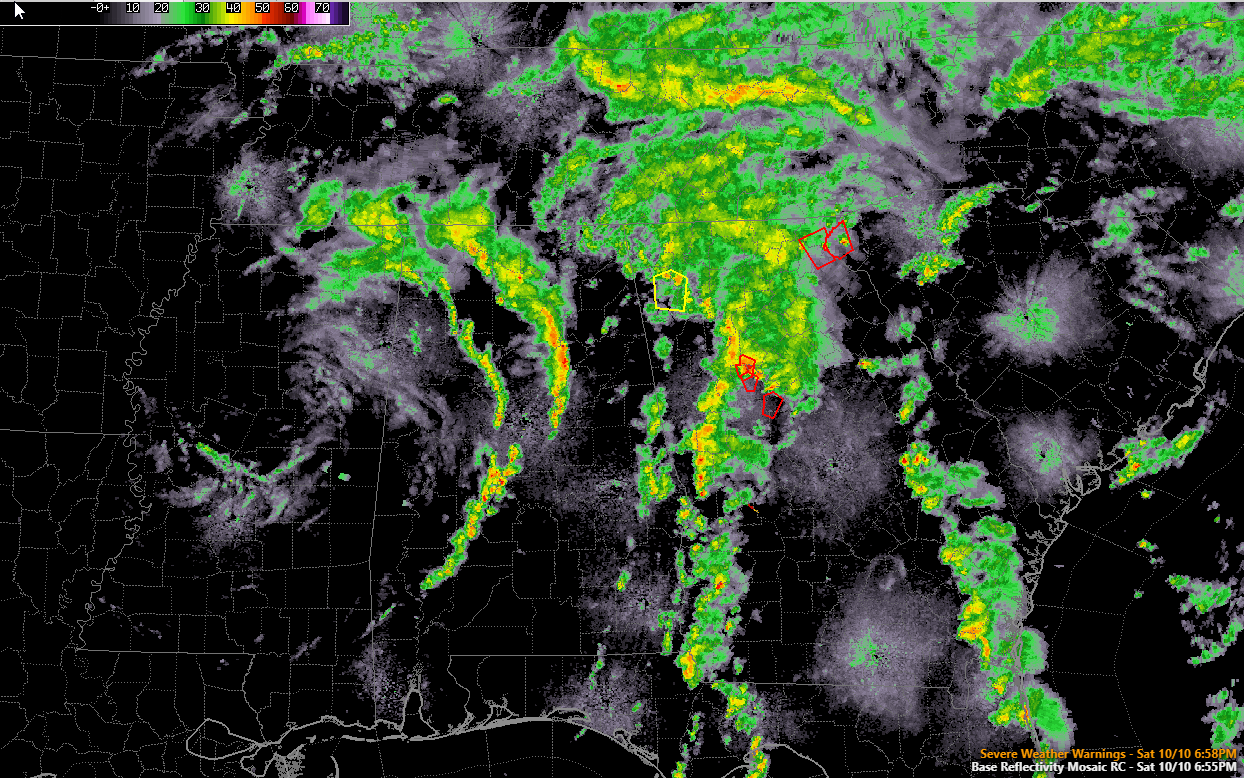
Alabama Update at 7 p.m.: Showers from the Remnants of Delta Continue Across Alabama
The remnant low of Hurricane Delta is centered over northern Mississippi between Greenwood and Columbus this evening.
The system is managing to produce at least four convective bands across the Southeast.
The first is over eastern Georgia. It is producing tornado warnings in northeastern Georgia.
The main one is over Central Georgia, with tornado warnings south of Atlanta.
The tornado watch continues over Georgia.
The third one moved through Birmingham about 5:30, producing heavy rain and beautiful rainbows. It now extends from east of Hartselle to east of Cullman to Oneonta to Pell City to west of Sylacauga.
The final one extends from eastern Franklin County into western Winston County to near Jasper in Walker County to western Jefferson County before it exhibits a break before picking back up over southwestern Chilton and eastern Perry Counties then extending into Dallas, Wilcox, and Clarke Counties.
No lightning in Alabama.
The severe weather is likely over for our state, but we will be monitoring. The new SPC Day One comes out within the hour.
Skies will remain mostly cloudy tomorrow with a few breaks in the clouds at times, especially late in the day. A few light showers will form, but coverage will be spotty and rainfall amounts light. Highs will be in the middle to upper 70s across North and Central Alabama with lower 80s down south.
Category: Alabama's Weather, ALL POSTS


