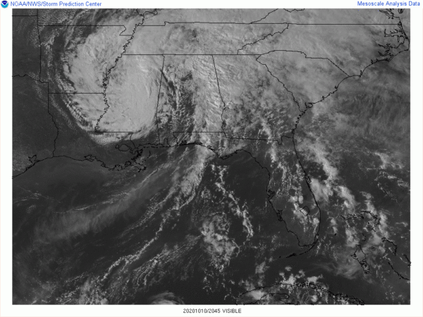
Delta Has Transitioned Into a Remnant Low
SUMMARY OF 400 PM CDT…2100 UTC…INFORMATION
———————————————-
LOCATION…33.7N 90.0W
ABOUT 80 MI…130 KM WSW OF TUPELO MISSISSIPPI
ABOUT 250 MI…400 KM SW OF NASHVILLE TENNESSEE
MAXIMUM SUSTAINED WINDS…30 MPH…45 KM/H
PRESENT MOVEMENT…NE OR 55 DEGREES AT 12 MPH…19 KM/H
MINIMUM CENTRAL PRESSURE…998 MB…29.47 INCHES
WATCHES AND WARNINGS
——————–
Flood and Flash Flood watches remain in effect for portions of the
Mid-South and areas in and near the southern Appalachians.
DISCUSSION AND OUTLOOK
———————-
At 400 PM CDT (2100 UTC), the center of Post-Tropical Cyclone Delta
was located near latitude 33.7 North, longitude 90.0 West. The
post-tropical cyclone is moving toward the northeast near 12 mph (19
km/h) and this motion is expected to become more east-northeasterly
on Sunday.
Maximum sustained winds are near 30 mph (45 km/h) with higher gusts.
Weakening is forecast during the next 36 hours, and Delta’s
surface low is expected to dissipate across West Virginia
late Sunday night.
The estimated minimum central pressure is 998 mb (29.47 inches).
HAZARDS AFFECTING LAND
———————-
WIND: Wind gusts to tropical-storm force are possible prior to
sunset over portions of Arkansas, Mississippi, and Alabama.
STORM SURGE: Water levels will continue to subside today along the
Louisiana coast. Consult products issued by your local National
Weather Service forecast office for additional information.
RAINFALL: In the Appalachian region of far northeast Georgia,
the western Carolinas, and western Virginia, the remnants of Delta
are expected to produce 3 to 6 inches of rain, which could lead to
flash, urban, small stream, and isolated minor river flooding.
From northern Alabama and the Tennessee Valley into the
Mid-Atlantic, 1 to 3 inches of rain, with locally higher
amounts, are expected. Minimal hydrologic impacts are expected.
Moderate to major river flooding will continue across the Calcasieu
and Vermilion river basins in Louisiana through much of next week.
TORNADOES: A few tornadoes are possible across parts of Alabama,
the Florida Panhandle, and western Georgia through early tonight.
SURF: Swells from Delta are gradually subsiding along the northern
Gulf coast. Please consult products from your local weather office
for additional information.
Category: ALL POSTS, Severe Weather, Tropical


