Tornado Threat Continues for Central Alabama Until Later This Evening
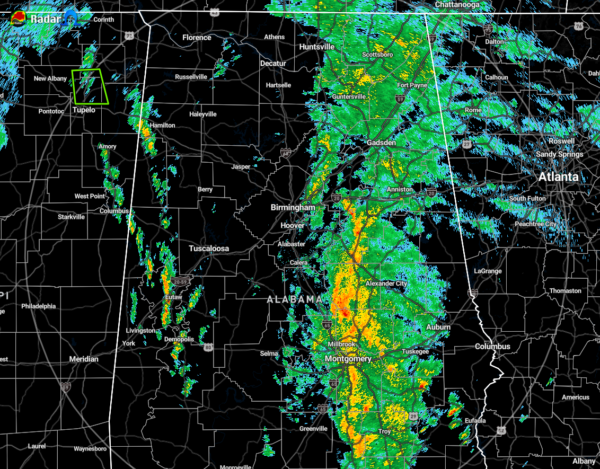
As of 1:40 pm, the good news continues to be that we have not had any tornado warnings issued sofar today across Central Alabama. The bad news is the primary threat of a few brief tornadoes are possible across Central Alabama thru 9:00 pm, with the highest threat south of I-20 and east of I-65. Therefore, we’ll continue to watch radar closely through the rest of the afternoon and evening hours.
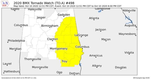
A Tornado Watch continues in effect until 8:00 pm for the following counties in Central Alabama: Barbour, Bullock, Calhoun, Chambers, Clay, Cleburne, Coosa, Elmore, Lee, Macon, Montgomery, Pike, Randolph, Russell, Talladega, Tallapoosa.
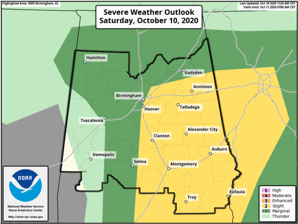
The Storm Prediction Center continues the Slight Risk for portions of Central Alabama along and east of a line from just east of Selma to Hoover to Center Point to Piedmont. The Marginal Risk continues for much of the rest of the area with the exception of locations along and west of a line from Millport to Moundville to Thomaston.
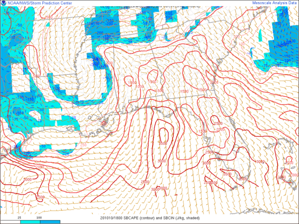
Surface-Based CAPE values (instability) continue to rise across the area, now reaching 500-1500 J/kg. Helicity values (potential for rotating updrafts) continue to climb as the dynamics of Delta continue to move further into the area. Combine those two ingredients with the higher sheared environment moving through the area, and the ingredients are there for a few tornadoes.
Timing for the potential of tornadoes in the risk areas goes from now to 4:00 pm for the western half of the risk areas to as late as 9:00 pm for the eastern half. Along with a few brief tornadoes, damaging wind gusts up to 60 MPH are possible but are less likely of a threat.
Category: Alabama's Weather, ALL POSTS, Severe Weather, Tropical


