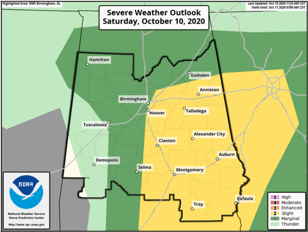
SPC Expands Slight Risk Just Before Midday
The Storm Prediction Center has expanded the Slight Risk for Central Alabama to now include portions of the area along and east of a line from just east of Selma to Hoover to Center Point to Piedmont. The Marginal Risk continues for much of the rest of the area with the exception of locations along and west of a line from Millport to Moundville to Thomaston.
Latest from the SPC:
SUMMARY…A few tornadoes are possible into this evening across parts of Alabama, western Georgia, and the Florida Panhandle.
AL/FL Panhandle/western GA…The weakening remnants of tropical cyclone Delta will move generally eastward across northern MS today to northern AL tonight. The system has a more baroclinic structure now with a warm front extending eastward from roughly Birmingham to Atlanta, and the primary surface trough near the MS/AL border. Most of the convection is focused in a north-south band across central/southern AL and the western FL Panhandle in the zone of strongest low-level confluence/convergence. Expect the main threat for embedded rotating storms to be focused within this band this afternoon as the stronger forcing for ascent spreads northeastward, and along the warm front as more isolated storms form in response to daytime heating in cloud breaks. The combination of boundary-layer dewpoints in the low-mid 70s, weak buoyancy (MLCAPE of 500-1000 J/kg), and sufficiently strong flow/shear east of the center of Delta will support a threat for occasional supercells and tornadoes this afternoon through late evening.
Category: Alabama's Weather, ALL POSTS, Severe Weather, Tropical


