A Quick Midday Update on Central Alabama’s Weather
WEATHER AT MIDDAY
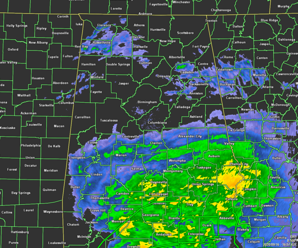
As 12:00 pm, much of the rain and wind associated with Hurricane Sally remains south of a line from Eutaw to Jemison to Roanoke for the moment, while there are some scattered light shower activity over the portions of the northern half of Central Alabama and up into the western half of North Alabama. Temperatures as of 12:00 pm were in the mid-60s to the mid-70s. Tuscaloosa was the warm spot at 75 degrees. Alexander City was the cool spot at 66 degrees. Birmingham was at 70 degrees.
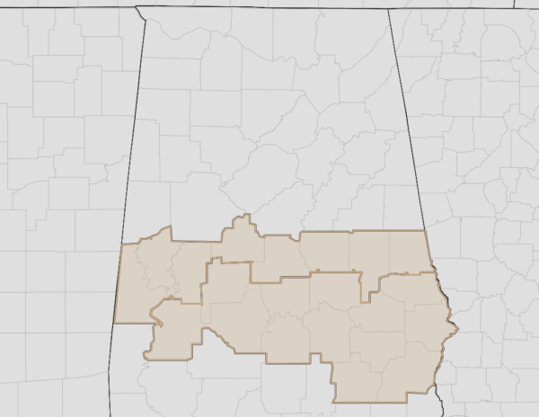
A Wind Advisory is currently in effect until 7:00 am Thursday for Sumter, Greene, Hale, Bibb, Chilton, Coosa, Tallapoosa, Chambers, Autauga, Barbour, Bullock, Dallas, Elmore, Lee, Lowndes, Macon, Marengo, Montgomery, Perry, Pike, and Russell counties in Central Alabama. Wind gusts up to 35 MPH may be possible as the northern parts of Sally move through the area. Gusty winds could blow around unsecured objects. Tree limbs could be blown down and a few power outages may result. Use extra caution when driving, especially if operating a high profile vehicle. Secure outdoor objects.
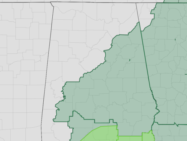
A Flash Flood Watch remains in effect until 1:00 pm Thursday for Autauga, Barbour, Bibb, Bullock, Calhoun, Chambers, Cherokee, Chilton, Clay, Cleburne, Coosa, Dallas, Elmore, Etowah, Hale, Lee, Lowndes, Macon, Marengo, Montgomery, Perry, Pike, Randolph, Russell, Shelby, St. Clair, Talladega, and Tallapoosa counties in Central Alabama. Periods of heavy rainfall are forecast to impact areas of Central Alabama today into Thursday in association with Sally. Forecast rainfall totals of 4 to 8 inches with locally higher amounts in the watch area could lead to significant flooding and flash flooding. This may become a life-threatening situation, if you are near water or live in a low lying area, pay particular attention to warnings issued and be prepared to take quick action to move to higher ground.
WEATHER FOR THE REST OF TODAY
So for the rest of today, the majority of the tropical rain and winds associated with Hurricane Sally will remain south of the I-59 corridor as she moves northeastward and eventually east-northeastward. Some flash flooding issues may occur where the heavier rain bands pass over. The southern half of Central Alabama may see sustained winds up to 30 MPH with gusts up to 45 MPH at times. There will also be a small tornado threat for locations along and south of the I-85 corridor from now through at least 11:00 pm tonight. For the rest of Central Alabama north of I-59, some scattered showers and maybe a few claps of thunder will move mainly westward across the area. Winds may be breezy at time, but high wind gusts are not expected. Afternoon highs will be in the lower to mid-70s for most.
THURSDAY’S WEATHER
We can expect breezy conditions across mainly the eastern half of Central Alabama during the day on Thursday as the western side of Sally will continue to move through and finally exiting the area. As that rainfall begins moving out of the area, some flash flooding issues may remain possible during the first half of the day in the flash flood watch locations. Severe weather is not expected throughout the day, but we will have to watch for the potential of some river flooding after the tropical rain amounts begin to pile up. Some rivers may go over flood stage and remain that way through the start to next week. Highs will be in the upper 70s to the mid-80s across the area.
HURRICANE SALLY
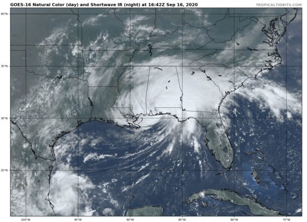
The center of Hurricane Sally was located about 20 miles to the north of Pensacola, Florida, and was moving slowly to the north-northeast at 5 MPH. Maximum sustain winds have come down to around 75 MPH. Sally may be a tropical storm by the time the next major advisory comes out from the National Hurricane Center. So far, according to the telemetry from the ASOS locations, the highest wind gusts since midnight are as follows:
Mobile/Bates Field: 81 MPH
Mobile Downtown: 75 MPH
Fairhope: 62 MPH
Andalusia/Opp Airport: 53 MPH
Greenville: 46 MPH
Unfortunately, the stations closest to the eye of Sally (Foley, Gulf Shores, etc.) apparently have been knocked offline due to the strong winds or high flood waters from rain or storm surge. That would not be a surprise at all as we know that a section of the three-mile bridge in Pensacola has been washed away. I-10 at the Alabama/Florida State Line has been closed in both directions due to flooding.
We’ll have more details as they come in. The 1:00 pm update will be released shortly.
Category: Alabama's Weather, ALL POSTS, Severe Weather, Tropical


