The Eyewall of Paulette is Nearing Bermuda; Hurricane Conditions Expected Within the Next Few Hours
SUMMARY OF 1100 PM AST…0300 UTC…INFORMATION
———————————————–
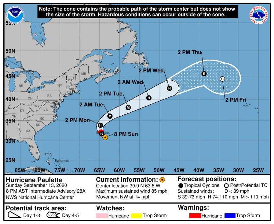
LOCATION…31.4N 64.0W
ABOUT 80 MI…125 KM SE OF BERMUDA
MAXIMUM SUSTAINED WINDS…85 MPH…140 KM/H
PRESENT MOVEMENT…NW OR 315 DEGREES AT 13 MPH…20 KM/H
MINIMUM CENTRAL PRESSURE…976 MB…28.82 INCHES
WATCHES AND WARNINGS
——————–
A Hurricane Warning is in effect for…
* Bermuda
DISCUSSION AND OUTLOOK
———————-
At 1100 PM AST (0300 UTC), the eye of Hurricane Paulette was located near latitude 31.4 North, longitude 64.0 West. Paulette is moving toward the northwest near 13 mph (20 km/h). Paulette is forecast to continue moving northwestward overnight and then turn northward on Monday. A faster motion toward the northeast is expected late Monday through Wednesday. On the forecast track, the eye of Paulette will move near or over Bermuda early Monday morning.
Data from an NOAA Hurricane Hunter aircraft indicate that the maximum sustained winds are near 85 mph (140 km/h) with higher gusts. Some strengthening is forecast as Paulette moves closer to Bermuda overnight and early Monday. Additional strengthening is likely when Paulette turns northeastward and moves away from Bermuda late Monday through Tuesday.
Hurricane-force winds extend outward up to 45 miles (75 km) from the center and tropical-storm-force winds extend outward up to 175 miles (280 km). Winds have steadily increased in Bermuda during the past few hours and will continue to increase during the next few hours. An unofficial observing station at Cedarvale South recently reported a wind gust of 62 mph (100 km/h). An automated station at Cresent reported a wind gust of 56 mph (90 km/h), and another station at Pearl Island reported a gust of 70 mph (112 km/h).
The estimated minimum central pressure based on data from the hurricane hunter plane is 976 MB (28.82 inches).
HAZARDS AFFECTING LAND
———————-
WIND: Tropical storm conditions are occurring on Bermuda now, and winds will steadily increase tonight. Hurricane conditions are expected to first reach Bermuda overnight and will continue until Monday morning.
STORM SURGE: A dangerous storm surge is expected to produce significant coastal flooding on Bermuda in areas of onshore winds. Near the coast, the surge will be accompanied by large and destructive waves.
RAIN: Paulette will bring periods of heavy rain to Bermuda through Monday, with rainfall of 3 to 6 inches expected.
SURF: Swells generated by Paulette are affecting portions of the Leeward Islands, the Greater Antilles, the Bahamas, Bermuda, and the east coast of the United States. These swells are likely to cause life-threatening surf and rip current conditions. Please consult products from your local weather office.
Category: ALL POSTS, Severe Weather, Tropical
About the Author (Author Profile)
Scott Martin is an operational meteorologist, professional graphic artist, musician, husband, and father. Not only is Scott a member of the National Weather Association, but he is also the Central Alabama Chapter of the NWA president. Scott is also the co-founder of Racecast Weather, which provides forecasts for many racing series across the USA. He also supplies forecasts for the BassMaster Elite Series events including the BassMaster Classic.Subscribe
If you enjoyed this article, subscribe to receive more just like it.


