An Unhappy Storm
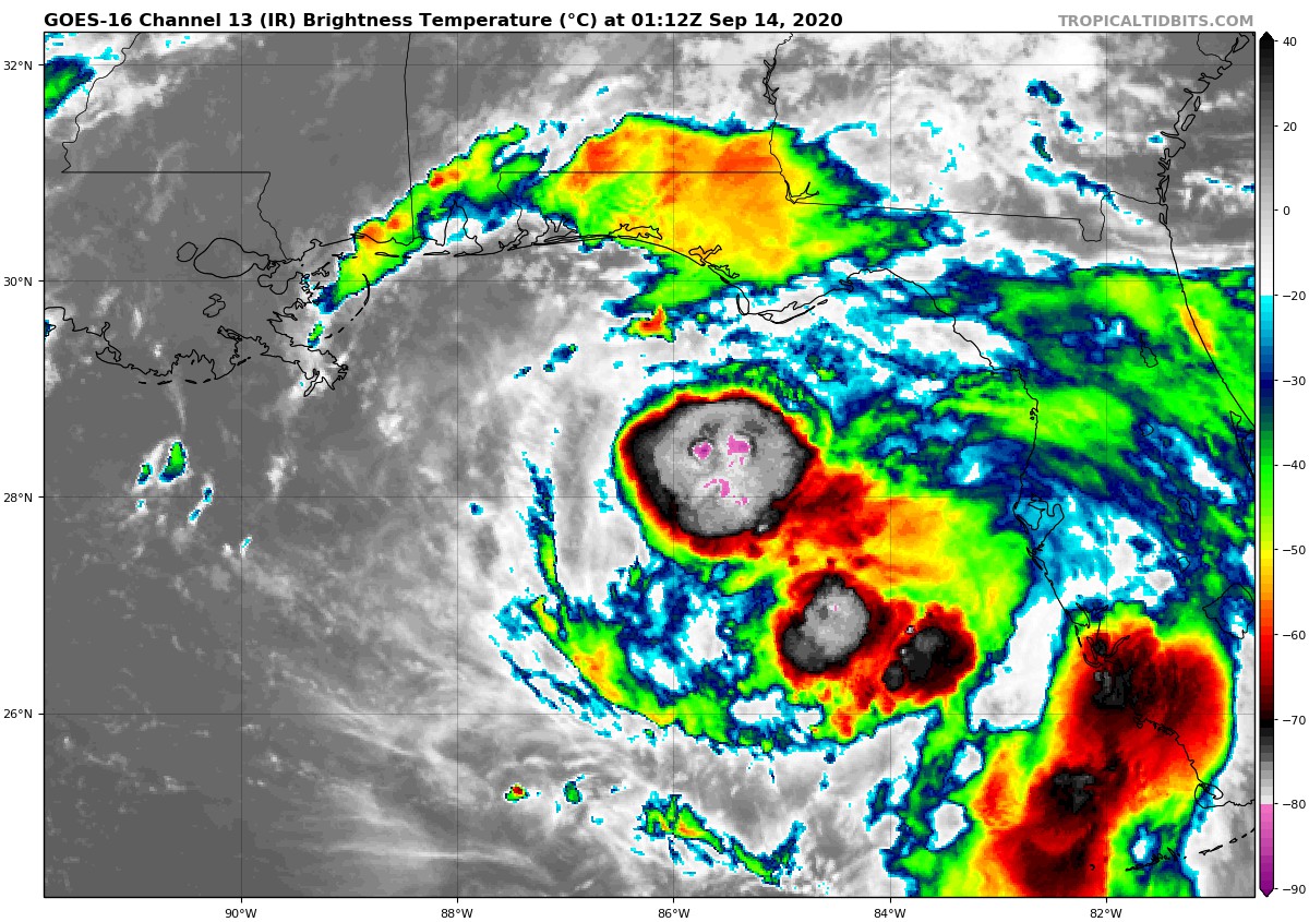
This infrared satellite image seems to show a frowny faced Sally in the northeastern Gulf of Mexico some 190 or so miles south-southwest of Panama City.
Those pink colors though are colder cloud tops that are colder than -80C, which are the coldest on the scale, so the storms are intensifying.
But the center is still just south of these storms according to the Air Force plane. It found a central pressure of 997 millibars just after 7 p.m. It found a 56 mph flight level wind, which is about a 50 mph surface wind. It measured max surface winds of 33 mph, but it was sampling the much weaker western side.
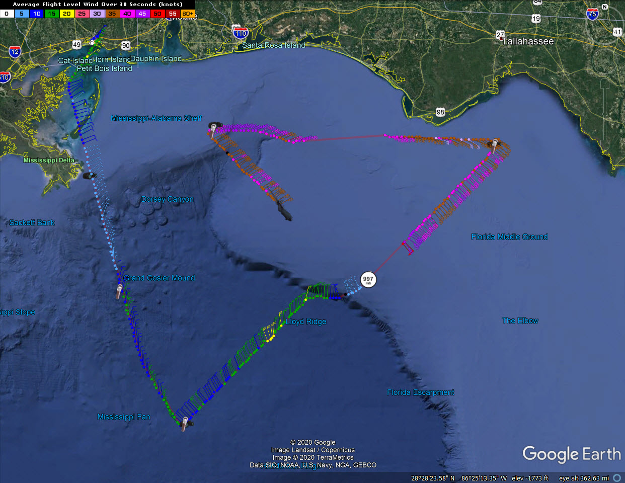
It is inbound right now for another center penetration. It has sampled the much stronger northeastern side this time and did find more widespread 45-50 knots flight level winds as well as a 52-knot surface wind.
Until the storms wrap around the center, the storm will not significantly strengthen. But it is expected to slow down as it approaches landfall late tomorrow afternoon and should become a hurricane by morning.
About the Author (Author Profile)
Bill Murray is the President of The Weather Factory. He is the site's official weather historian and a weekend forecaster. He also anchors the site's severe weather coverage. Bill Murray is the proud holder of National Weather Association Digital Seal #0001 @wxhistorianSubscribe
If you enjoyed this article, subscribe to receive more just like it.


