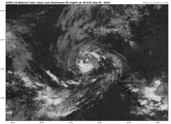
TD-18 Strengthens to Become Tropical Storm Rene
SUMMARY OF 400 PM CDT…2100 UTC…INFORMATION
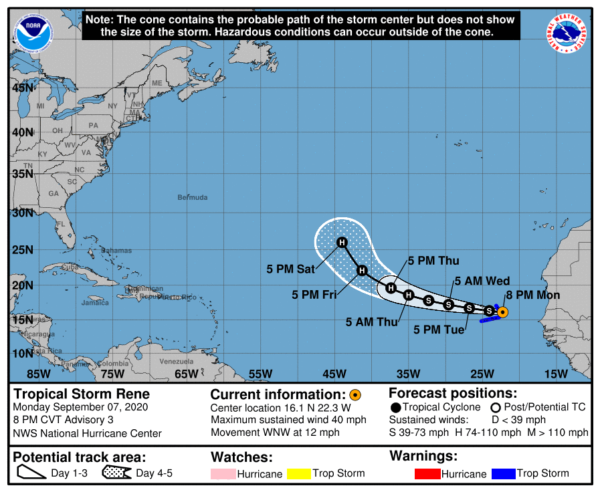
LOCATION…16.1N 22.3W
ABOUT 115 MI…180 KM E OF THE CABO VERDE ISLANDS
MAXIMUM SUSTAINED WINDS…40 MPH…65 KM/H
PRESENT MOVEMENT…WNW OR 295 DEGREES AT 12 MPH…19 KM/H
MINIMUM CENTRAL PRESSURE…1001 MB…29.56 INCHES
WATCHES AND WARNINGS
A Tropical Storm Warning is in effect for…
* Cabo Verde Islands
DISCUSSION AND OUTLOOK
At 800 PM CVT (2100 UTC), the center of Tropical Storm Rene was located near latitude 16.1 North, longitude 22.3 West. Rene is moving toward the west-northwest near 12 mph (19 km/h), and this motion with some increase in forward speed is expected over the next few days. On the forecast track, the center of the cyclone is will pass near or over the Cabo Verde Islands tonight and early Tuesday.
Maximum sustained winds are near 40 mph (65 km/h) with higher gusts. Gradual strengthening is forecast, and Rene could become a hurricane in two or three days.
Tropical-storm-force winds extend outward up to 45 miles (75 km)
from the center.
The estimated minimum central pressure is 1001 MB (29.56 inches).
HAZARDS AFFECTING LAND
RAINFALL: Rene is expected to produce 2 to 5 inches of rain across portions of the Cabo Verde Islands through Tuesday.
WIND: Tropical storm conditions are expected to begin over the eastern portions of the Cabo Verde Islands later this evening and spread westward across the remainder of those islands through early Tuesday.
SURF: Swells generated by Rene are expected to spread westward across the Cabo Verde Islands tonight and early Tuesday. These swells are likely to cause life-threatening surf and rip current conditions.
Category: ALL POSTS, Severe Weather, Tropical


