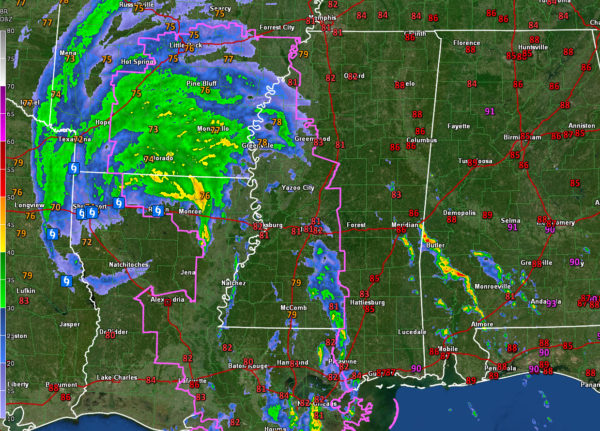
Storms Over West Alabama
The center of still Hurricane Laura is passing just west of Ruston, LA at this hour. There are no observations from stations like Ruston, Alexandria, or Natchitoches because of power failures. Winds gusted to 86 mph at Alexandria just before 8 a.m. before the power failed. Power is out to over 93% of the residents of Rapides Parish, where Alexandria is located.
Barksadale AFB just had a gust to 52 mph.
The storm is moving north at 17 mph and will be south of Little Rock by 7 p.m., passing east of the Arkansas capital overnight and then moving through the Ohio Valley and Mid-Atlantic states before re-emerging over the Atlantic, where it may redevelop.
There are a couple of feeder bands to the east of Laura, one over Mississippi, and one into Southwest Alabama.
There is a warm and steamy air mass over Alabama, with dewpoints in the middle 70s. It feels quite tropical, and the air mass is unstable, with CAPE values over 3,000 across much of the area. The convergence provided by the feeder bands will power thunderstorms that will lift northeast through the day.
Those storms now cover parts of Choctaw, Clarke, Monroe, and Escambia Counties. Other showers and storms are over pats of Wilcox, Monroe, Conecuh, and Covington Counties.
Severe weather is not expected as all of the helicity is back to the west over Mississippi, Louisiana, and Arkansas where tornadoes watches are in effect. So the main effects will be heavy rain and gusty winds, but we will keep an eye on them.
Severe weather is possible tomorrow over the Tennessee Valley as the tropical depression that is leftover from Laura passes to our north.
Category: Alabama's Weather, ALL POSTS


