New Tornado Watch Likely for parts of Louisiana, Arkansas, & Mississippi
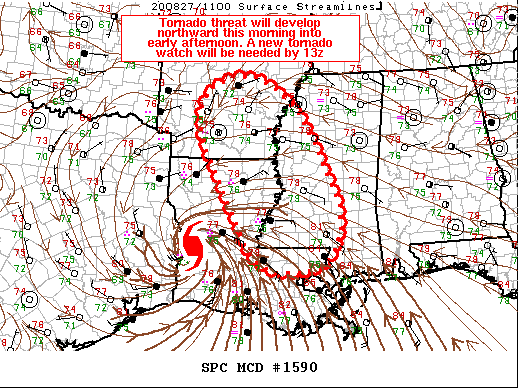
SUMMARY…The tornado threat associated with embedded supercells in feeder bands associated with Hurricane Laura is expected to increase this morning into early afternoon. A new tornado watch will be needed by 13z.
DISCUSSION…Hurricane Laura continues to track northward across western LA this morning. A relative minimum in tornado activity has occurred overnight, but conditions are expected to rapidly improve through the morning hours to the east of Laura’s center from eastern LA into western MS and southeast AR. Southeasterly low-level flow currently across southeast LA into southern MS will continue to bring a corridor of 76-78 F surface dewpoints north/northwestward through the morning hours as low-level flow becomes more southeasterly with time and northward extent across the MCD area. Cloud cover and bands of rainfall will limit heating somewhat but expect temperatures to warm into the low to mid 80s F. As a result, a corridor of MLCAPE around 1000-2000 J/kg seems reasonable within the MCD area. Forecast RAP soundings show rapidly increasing low-level hodographs through the morning, with storm motion, adjusted 0-1 km SRH values exceeding 200 m2/s2. Given an overall thermodynamic and kinematic parameter space conducive to supercells, especially where any stronger insolation/destabilization occurs, a tornado threat should increase during the morning and early afternoon hours from south to north across the MCD area.
Category: ALL POSTS, Severe Weather, Tropical


