Occasional Showers Over The Weekend; Tropical Trouble Next Week???
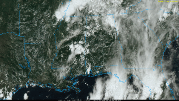
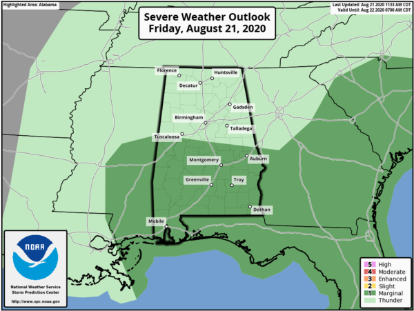
RADAR CHECK: Showers and thunderstorms are increasing again this afternoon across Alabama; they are moving to the northeast, and the heavier storms will be capable of producing torrential rain, gusty winds, and small hail. SPC maintains a “marginal risk” (level 1/5) of severe thunderstorms over about the southern half of the state through tonight.
Showers could linger well into the night in the moist, unstable air over Alabama thanks an upper trough overhead.
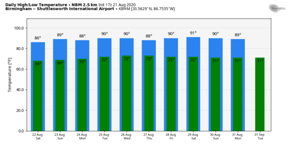
THE WEEKEND: Not much change; the sky will be cloudy at times tomorrow and Sunday with scattered to numerous showers and thunderstorms both days. Daytime temperatures will remain below average with highs in the mid to upper 80s. Most of the showers will come from noon to midnight, but we can’t rule out a few late night or morning shower in this environment.
NEXT WEEK: There is great uncertainty in how the weather plays out due to the fact that two tropical systems are in play. How they behave will determine our weather. We will trend toward increased rain coverage over the latter half of the week as deep tropical moisture is pulled northward into the state, but it is too early to know if we will have any risk of really heavy rain or flooding. Possibly, but just too early to call. See the Weather Xtreme video for maps, graphics, and more details.
TROPICS: In the far eastern Atlantic, a tropical wave now has only a low chance of development over the next five days. The attention will be focused on Tropical Storm Laura, and Tropical Depression 14, which should soon become Tropical Storm Marco.
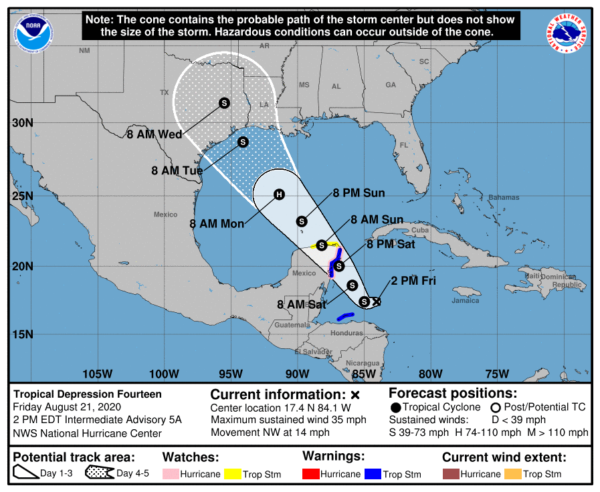
TD 14: The depression is moving away from the coast of Honduras this afternoon, and is expected to reach tropical storm strength this evening or tonight. The latest forecast track from NHC shows the system briefly becoming a category one hurricane in the western Gulf of Mexico Monday, followed by weakening Monday night and Tuesday. Landfall is forecast around Galveston Tuesday as an upper end tropical storm; heavy rain and flooding will be the primary threats if this scenario plays out.
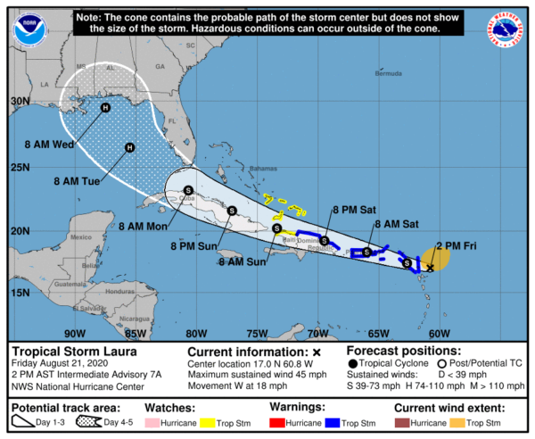
TROPICAL STORM LAURA: Laura is moving through the Leeward Islands this evening with winds of 45 mph. It will move over Puerto Rico tomorrow, and then it skirts the northern coasts of Hispaniola and Cuba Sunday and Monday. The latest NHC forecast brings the system to hurricane strength Monday night in the Gulf, and the latest forecast position is south of Gulf Shores Wednesday morning as a category one hurricane.
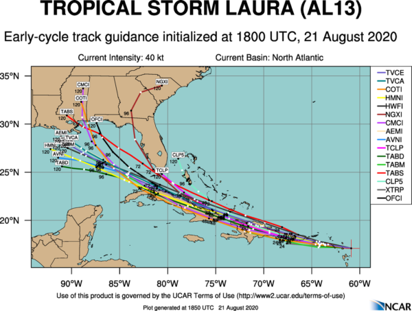
It is important to note there is great uncertainty involved in the forecast track and intensity of Laura due to potential interaction with land, especially Hispaniola and Cuba, and interaction with the other tropical system to the west in the Gulf of Mexico (what should be Tropical Storm Marco soon).
We note the 18Z model set shows Laura staying south of the Alabama and Florida Gulf Coast, being pulled in the general direction of Marco. Potentially the Fujiwhara effect.
Will the two merge to form a super duper mega storm? No. If they are relatively close, circulations are disrupted causing one or both to weaken. Tracks can change as they try to pinwheel around each other.
We also note the major global models (the American GFS and the European ECMWF) show little development with both systems.
It is still too early to forecast impacts next week for any specific point on the Gulf Coast. I would not cancel a trip to the beaches (anywhere from Gulf Shores to Panama City Beach), but pay very close attention to updates over the weekend and early next week while you are there. We should have much better clarity over the weekend as the systems get better organized and we have data from Hurricane Hunter dropsondes incorporated into models.
ON THIS DATE IN 1883: An estimated F5 tornado caused extensive damage to Rochester Minnesota on this day. The enormous roar was said to have warned most Rochester residents, as the massive funnel cut through the north side of town. Over 135 homes were destroyed, and another 200 damaged. Many of the 200 plus injuries were severe, and other deaths probably occurred but not listed as part of the 37 total mentioned. This damaging tornado eventually led to the formation of the Mayo Clinic.
BEACH FORECAST: Click here to see the AlabamaWx Beach Forecast Center page.
WEATHER BRAINS: Don’t forget you can listen to our weekly 90 minute show anytime on your favorite podcast app. This is the show all about weather featuring many familiar voices, including our meteorologists here at ABC 33/40.
CONNECT: You can find me on all of the major social networks…
Facebook
Twitter
Instagram
Pinterest
Snapchat: spannwx
Look for my next Weather Xtreme video here by 7:00 a.m. Monday… enjoy the weekend!
Category: Alabama's Weather, ALL POSTS, Weather Xtreme Videos


