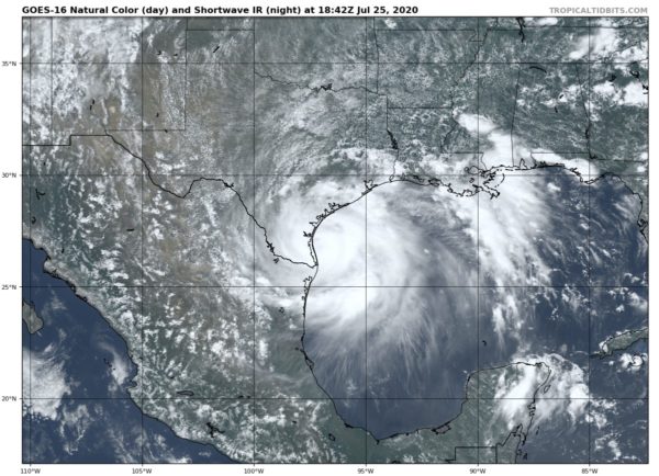
Hanna Strengthens Even More Just Before Landfall
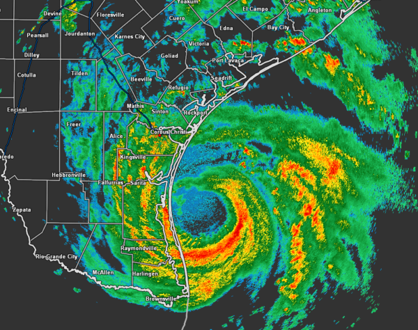
As you can see by the attached radar image, the eyewall is now starting to move onshore in southern Texas just t the north of Port Mansfield and south of Chapman Ranch.
SUMMARY OF 200 PM CDT…1900 UTC…INFORMATION
LOCATION…27.0N 96.8W
ABOUT 55 MI…90 KM ENE OF PORT MANSFIELD TEXAS
ABOUT 75 MI…120 KM SE OF CORPUS CHRISTI TEXAS
MAXIMUM SUSTAINED WINDS…85 MPH…140 KM/H
PRESENT MOVEMENT…W OR 260 DEGREES AT 8 MPH…13 KM/H
MINIMUM CENTRAL PRESSURE…973 MB…28.73 INCHES
A TCOON observing station at Laguna Madre, Texas, recently reported a sustained wind of 63 mph (102 km/h) and a gust to 79 mph (128 km/h).
Data from the Air Force Reserve reconnaissance aircraft indicate that the minimum central pressure inside the eye of Hanna is 973 MB (28.73 inches).
EARLIER OBSERVATIONS
12:00 PM
An NOAA National Ocean Service observation platform at Bob Hall Pier on Padre Island recently reported a wind gust of 68 mph (109 km/h).
NOAA buoy 42020 recently reported a minimum pressure of 978.1 MB (28.88 inches) inside the eye of Hanna.
11:00 AM
NOAA buoy 42020 recently reported sustained winds of 35 mph (93 km/h) at a height of 12 ft (3.7 m) just inside the southwestern portion of Hanna’s eye. The buoy also measured a pressure of 980.9 MB (28.96 inches).
A wind gust to 46 mph (74 km/h) was also recently observed at Baffin Bay, Texas.
9:00 AM
NOAA buoy 42020 recently reported sustained winds of 56 mph (90 km/h) and a gust to 63 mph (101 km/h) near the southwest eyewall of Hanna at a height of 12 ft (3.7 m).
KEY MESSAGES
1. Life-threatening storm surge is occurring along portions of the Texas coast from Port Mansfield to Sargent, where a Storm Surge Warning is in effect.
2. Hurricane conditions are expected along the Texas coast from Port Mansfield to Mesquite Bay, where a Hurricane Warning is in effect.
3. Hanna is expected to produce heavy rains across portions of southern Texas and northeastern Mexico. These rains could result in life-threatening flash flooding and isolated minor to moderate river flooding.
Category: ALL POSTS, Severe Weather, Tropical


