Scattered Strong Storms Continue As We Approach Sunset
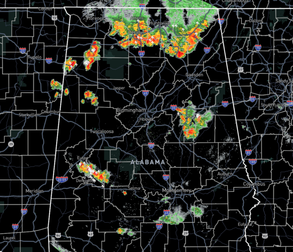
At 6:54 pm, we continue to have several clusters of storms across a good portion of North Alabama and a few loud storms in the central and southern parts of Central Alabama as well.
The heaviest and strongest activity is occurring over the Tennessee River in North Alabama stretching from Rogersville in Lauderdale County to Sulphur Springs in Jackson County. A few more scattered storms are close by to that cluster over portions of Franklin, Fayette, Marion, and Lamar counties.
Another big storm is located over portions of Greene, Hale, and Perry counties with plenty of lightning occurring around Sawyerville at the moment.
And another cluster of storms is located over the Talladega National Forest in Talladega and Clay counties. This one has been on the decrease for the past few scans and lightning production has dropped.
We have had several reports of trees and limbs reported downed with the current activity and with the activity that moved through the eastern parts of the area during the early afternoon hours. An outdoor shed was blown on its side at Piney Chapel Elementary School in Athens (Limestone Co.). Shingles were blown off of a building just northwest of Madison (Madison Co.).
As we lose the sunlight, most of these storms will die down quickly, but a few showers may linger for a little while longer. We’ll have another wave move in later tonight and during the overnight hours as a boundary will be moving into the area from the north. Those storms may make it to the I-20 corridor by 7:00 am Wednesday, if they hold together.
Category: Alabama's Weather, ALL POSTS, Severe Weather


