Humid Summer Days; Scattered Showers And Storms Again Today
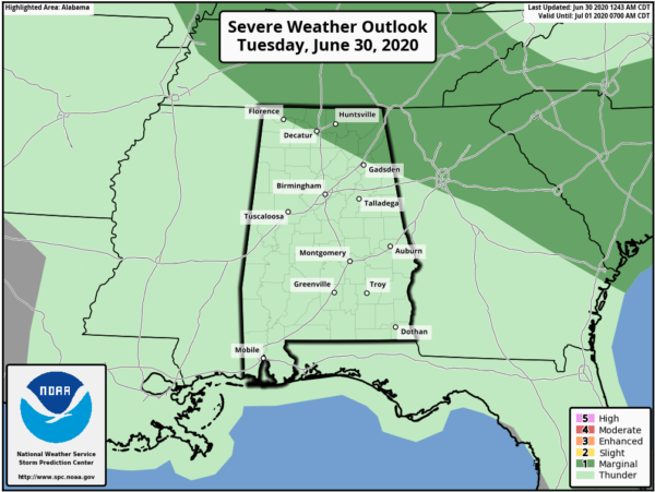
HUMID MORNING: it is a muggy late June morning across Alabama with dew points in the 70s for most communities. We note a few sprinkles over West Alabama, but the better chance of showers and thunderstorms will come later today as the air heats up and becomes unstable. SPC has a “marginal risk” (level 1/5) of severe thunderstorms defined for the northeast counties of the state this afternoon; heavier storms will be capable of strong straight line winds and some hail.
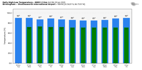
We expect a high in the 88-92 degree range this afternoon; the average high for Birmingham on June 30 is 90.
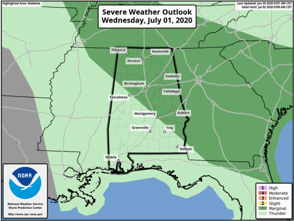
REST OF THE WEEK: Not much change tomorrow; another very humid day with scattered showers and strong storms by afternoon. SPC has a pretty good part of the state in a “marginal risk” (level 1/5) once again for potential for wet microbursts (local areas of strong, possibly damaging winds).
Thursday and Friday will be much the same with a mix of sun and clouds along with “scattered, mostly afternoon and evening showers and thunderstorms”. Highs will be in the 87-90 degree range for most communities.
FOURTH OF JULY WEEKEND: Very high PWAT (precipitable water) values will cover Alabama and the Deep South, so the weather will be very humid Saturday and Sunday with a mix of sun and clouds. And, on both days we will have to dodge showers and thunderstorms. Most of them (but not necessarily all) will come from about 1:00 until 9:00 p.m… and odds of any one spot getting wet both days will be around 50/50. No way of knowing in advance exactly when and where they form, you will just have to watch radar trends if you have some event planned outdoors. And, remember, when you hear thunder, get inside. Summer storms can pack hundreds of dangerous ground strokes. Highs will be in the mid to upper 80s.
NEXT WEEK: We will keep the persistence forecast going. Partly sunny days with the random, scattered showers and storms around each afternoon. Highs will be in the 86-91 degree range… See the Weather Xtreme video for maps, graphics, and more details.
TROPICS: A trough of low pressure is located off the coast of North Carolina. Significant development of this system is not anticipated while it moves generally northeastward, away from the east coast of the United States and merges with a frontal boundary. The rest of the Atlantic basin is very quiet.
ON THIS DATE IN 1912: An estimated F4 tornado ripped through Regina, Saskatchewan, Canada on this day. The storm became the deadliest tornado in Canada’s history as it killed 28 people along a rare, 18.5-mile track from south to north.
BEACH FORECAST: Click here to see the AlabamaWx Beach Forecast Center page.
WEATHER BRAINS: Don’t forget you can listen to our weekly 90 minute show anytime on your favorite podcast app. This is the show all about weather featuring many familiar voices, including our meteorologists here at ABC 33/40.
CONNECT: You can find me on all of the major social networks…
Facebook
Twitter
Instagram
Pinterest
Snapchat: spannwx
Look for the next Weather Xtreme video here by 4:00 this afternoon… enjoy the day!
Category: Alabama's Weather, ALL POSTS, Weather Xtreme Videos


