Clouds & Showers Out There At Midday; Severe Storm Threat Begins Before Sunrise
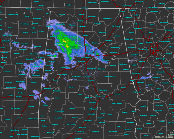
As of 11:48 am, we have some shower activity moving across the north and northwestern parts of Central Alabama with a few scattered light showers moving into the western parts of the area. The rest of Central Alabama has partly to mostly cloudy skies. Temperatures were in the upper 50s to the lower 70s across the area. Birmingham was at 63 degrees. The warm spot was Troy at 73 degrees. The cool spot was Haleyville at 57 degrees.
We’ll continue to have showers pushing across the northern parts of the area through the rest of the afternoon hours, but rain chances will increase across all of Central Alabama as we get into the evening and late-night hours. A few storms could be strong to severe with damaging winds and large hail as the main threats. Afternoon highs will be in the 70s with lows dropping into the mid-50s to the lower 60s.
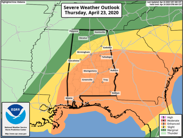
A LEVEL 3 ENHANCED RISK is up for locations along and south of a line from Ward (Sumter Co.) to Fultondale (Jefferson Co.) to Jacksonville (Calhoun Co.). Tornadoes (a strong tornado possible), damaging winds up to and possibly exceeding 70 MPH, and hail up to golf ball size will be the threats in the enhanced risk defined area.
A LEVEL 2 SLIGHT RISK is up for locations along and south of a line from Millport (Lamar Co.) to Vinemont (Cullman Co.) to Henagar (Dekalb Co). Damaging winds up to and possibly exceeding 60 MPH, hail up to quarter size, and perhaps a tornado or two will be the threats in the slight risk defined area.
A LEVEL 1 MARGINAL RISK is up for locations in the extreme northwestern parts of Central Alabama and the rest of North Alabama north of the slight risk defined area. A very low chance of damaging winds up to 60 MPH and hail up to quarter size will be possible in the marginal risk defined area.
The main window for strong to severe storms will be from as early as 4:00 am Thursday morning to as late as 6:00 pm Thursday evening. For the western locations (including Hamilton, Double Springs, Jasper, Vernon, Fayette, Tuscaloosa, Eutaw, & Livingston), the timing will be from 4:00 am to 2:00 pm.
For the central and northeast locations (including Cullman, Oneonta, Gadsden, Ashville, Birmingham, Columbiana, Talladega, Centerville, Clanton, Wetumpka, Prattville, & Fort Deposit), the timing will be from 6:00 am to 4:00 pm.
For the east and southeastern locations (Heflin, Ashland, Wedowee, Rockford, Dadeville, Lafayette, Opelika, Tuskegee, Phenix City, Montgomery, Union Springs, Troy, & Eufaula), the timing will be from 8:00 am to 6:00 pm.
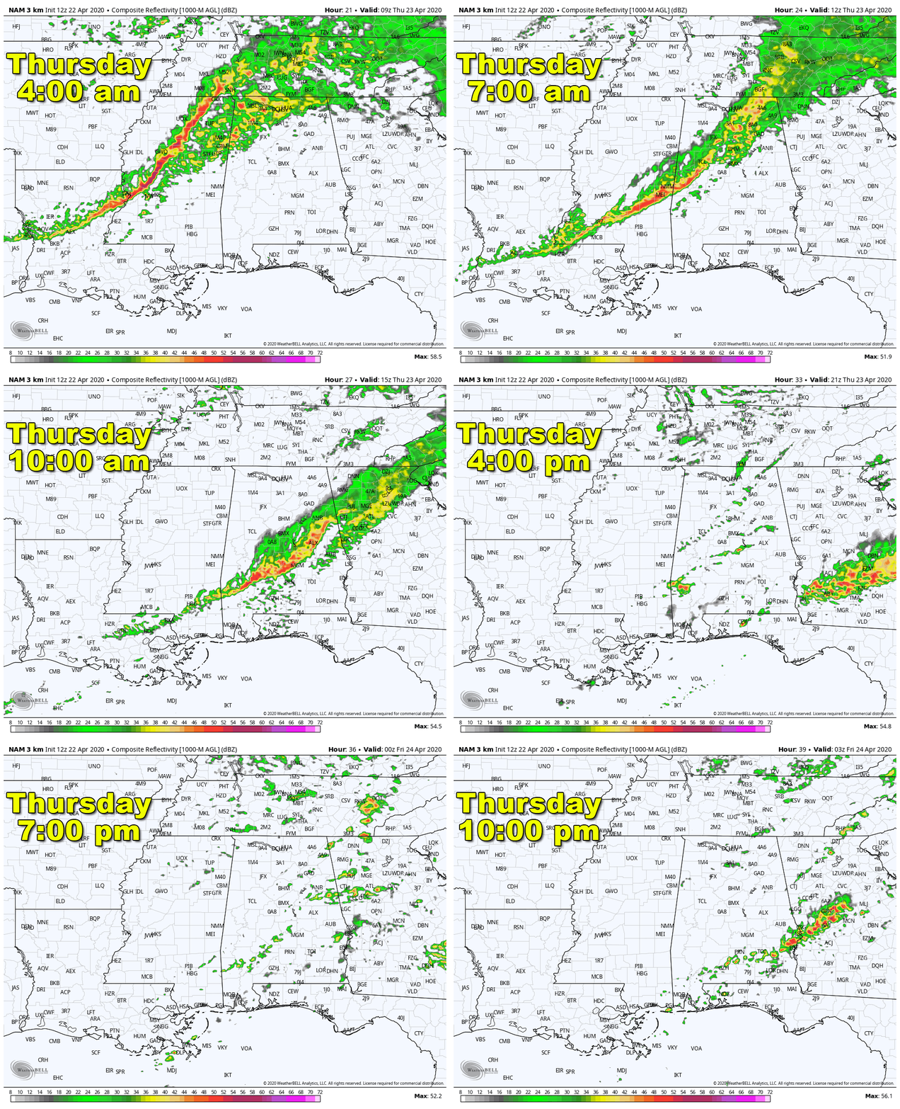
We’ll start off the early morning hours with a line of elevated thunderstorms that will begin to push into the northwestern corner of the state around 4:00 am and move into the northwestern parts of Central Alabama soon after. This line of storms will push through the area rather quickly and will be exiting the southeastern parts of the area around midday or just after. The main threats with this first round will be damaging winds and large hail. A tornado threat would be very very low as these will not be surface-based storms.
By the mid to late afternoon hours, this model run shows some scattered surfaced-based activity starting to fire up. This will be dependent on just how much the atmosphere can recover from the first round of storms. This run shows a great deal of instability moving up across all of the enhanced and into the slight risk defined areas. There will be plenty of helicity available and lapse rates will be rather steep. If this solution is true, tornadoes, damaging winds, and large hail will be possible with any storms that form… some of which may take on a supercellular form. That is why there is wording that a strong tornado is not out of the question.
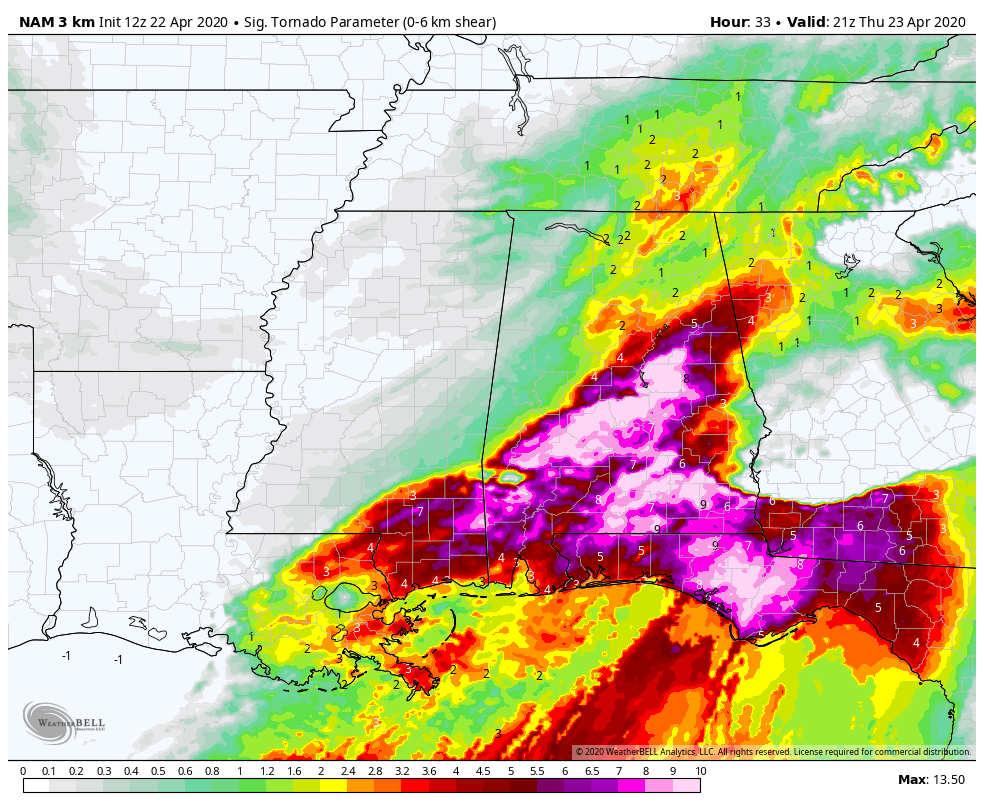
This is the Significant Tornado Parameter valid at 4:00 pm Thursday afternoon and we can see values maxing out above 9.0 over the south and southeastern parts of the area. Remember, significant tornadoes will be possible with values over 1.0. The higher the value, the higher the chances.
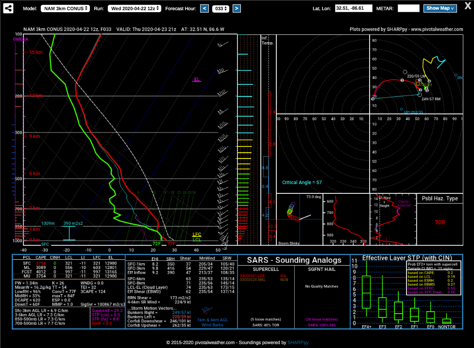
This is the latest sounding for the Prattville area valid at 4:00 pm Thursday from the latest run of the high-resolution NAM. It is showing instability values well over 3700 J/kg, shear over 60 knots, helicity over 400 m2/s2, lapse rates at 7.7º C/km, and an STP of 8.8. This clearly shows that all modes of severe weather will be possible.
One note is that this model run also shows thunderstorms continuing until 10:00 pm and possibly later. If this continues, we may need to extend the severe window later into the evening. Keep up to date as this forecast is still coming together and more details are getting ironed out.
Category: Alabama's Weather, ALL POSTS, Severe Weather


