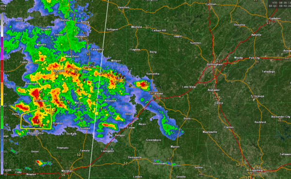
Storms Over Eastern Mississippi Pose Threat for Increasing Heavy Rain, Hail As They Move Into Central Alabama This Morning
Storms over eastern Mississippi associated with an upper-level disturbance and advancing warm front continue to expand in coverage and increase in intensity this morning, especially as the level jet increases.
There is a severe thunderstorm warning right now for parts of Neshoba and Winston Counties in Mississippi, including the area north of Philadelphia. Hail is the main threat here although there could be winds to 60 mph. Lots of torrential rain, lightning as well. This storm will approach Sumter, Greene and Pickens Counties within the hour.
Rainfall amounts will continue to increase and rainfall rates could approach 1.5 inches per hour with the heavier cells. Rainfall amounts could reach 2.5 inches this morning in activity associated with the warm front as it pushes northeast across Central Alabama. This could cause flash flooding this morning, and will certainly set the stage for additional problems later this afternoon and tonight when more rain is expected.
A flash flood watch is in effect for much of Central Alabama as well as parts of South Alabama until early Monday.
The latest model data this morning reinforces the ideas of a significant severe weather threat for Central Alabama, especially along and south of the track of a surface low that will move across the state tonight. I will have the video available before 6 a.m. and frequent updates throughout the event.
Category: Alabama's Weather, ALL POSTS, Severe Weather


