Timing Adjusted For Threat Of Severe Storms Across North/Central Alabama

The latest trends off to our west and with the warm front passing through the area, we can start to get a better handle on the timing of the potential of severe storms across the area.
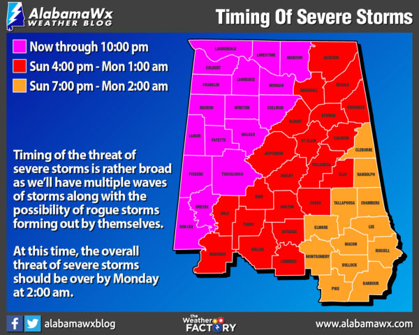
West of a line from Demopolis to Sumiton to Huntsville will be from now through 10:00 pm tonight.
East of that to a line stretching from Fort Deposit to Alexander City to Fruithurst will be from 4:00 pm this afternoon through Monday at 1:00 am.
The southeastern parts of the area will be from 7:00 pm tonight through Monday at 2:00 am.

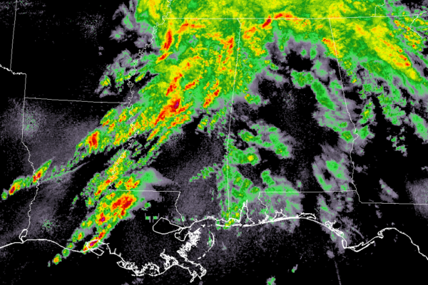
At 2:15 pm, radar continues to show storms moving northeastward through north and northwest Alabama, all of north and central Mississippi, and back into eastern Louisiana.
Destabilization of the atmosphere is underway from the south to the north across North/Central Alabama. A cap has formed that is keeping thunderstorm development held at bay for the moment, but the bad news is the instability will continue to build throughout the afternoon and into the early evening hours.
The threat of tornadoes, some of which could be strong to violent, long-track tornadoes, will increase through the afternoon and into the evening hours and we may have rogue supercells form when the cap erodes.
Later tonight, the severe threat will transition more into a convective squall line form with damaging winds up to and exceeding 70 MPH, large hail, and embedded tornadoes.
Category: Alabama's Weather, ALL POSTS, Severe Weather


