Heavy Rain Moving Through Birmingham Metro, Parts of Central Alabama
Here is the radar as of 10:45:

The rain is mostly pushing easts, but sagging slowly southward as well ahead of large high pressure to the north of the Great Lakes.
Here are surface dewpoints and observations, showing the cold front nice to the north of I-20.
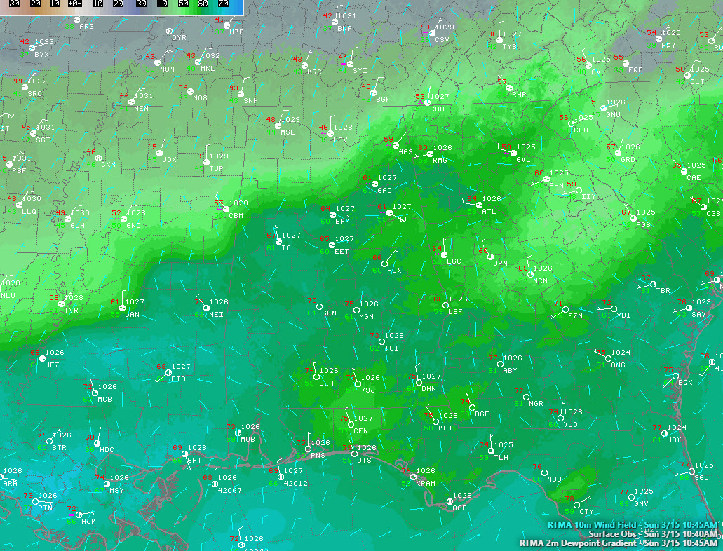
Notice the backdoor cold front to the east of Georgia. It is that area of lighter green, showing lower dewpoints surging from South Carolina down into Georgia. This front will work into eastern Alabama today.
Temperatures are in the 40s over the Tennessee Valley. In the transition zone near the front, readings range from the middle 50s to middle 60s.
Clouds are thick over the northern half of Alabama, with sunshine to the south.

The showers will continue tracking to the east and slightly southeast, exiting the state by this evening.
Category: Alabama's Weather, ALL POSTS
About the Author (Author Profile)
Bill Murray is the President of The Weather Factory. He is the site's official weather historian and a weekend forecaster. He also anchors the site's severe weather coverage. Bill Murray is the proud holder of National Weather Association Digital Seal #0001 @wxhistorianSubscribe
If you enjoyed this article, subscribe to receive more just like it.


