A Late Night Check On Our Weather For Now & For Wednesday
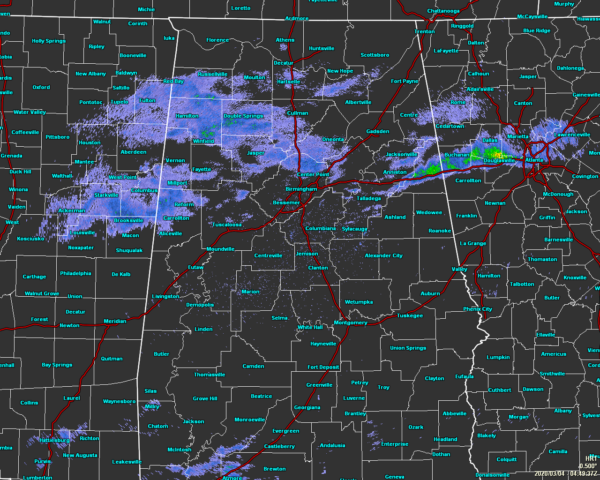
As of 10:50 pm, much of Central Alabama is rather quiet as there are some very light showers or sprinkle falling mainly west of I-59 and north of I-20/59. There are some light showers that are in the process of moving out of the state on the east and northeastern parts of the area. The rest of Central Alabama is dry. That will change during the pre-dawn hours as more rain and thunderstorms will begin to move into the area from the southwest as the surface low over west-central Texas moves eastward and will eventually move over the Gulf Coast of Louisiana and Mississippi over the next couple of days.
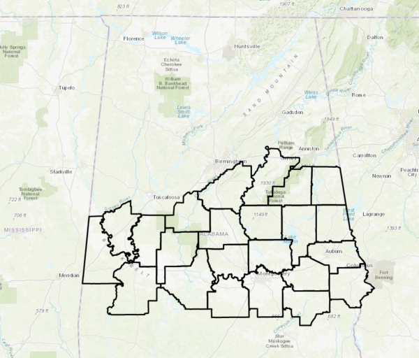
We also have a Dense Fog Advisory in effect through 6:00 am Wednesday for a good portion of Central Alabama.
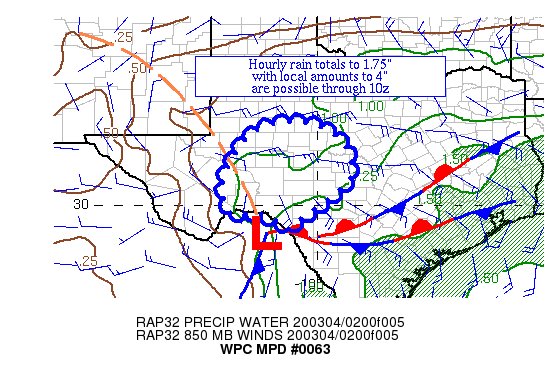
According to the latest Mesoscale Precipitation Discussion from the NWS WPC, that low is causing excessive rainfall over the west-central parts of Texas at the moment. From now until 4:00 am, rainfall totals could reach as high or exceed 4.00 inches which could lead to some flash flooding issues. That will almost be like what we’ll see across the southern two-thirds of Central Alabama as the latest guidance shows us receiving as much as an additional 1-3 inches of rain with the potential of a few locations exceeding that.
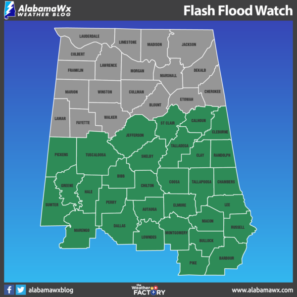
For that reason, NWS Birmingham has issued a FLASH FLOOD WATCH for the majority of Central Alabama starting at 6:00 am Wednesday morning and set to expire at 12:00 pm Thursday.
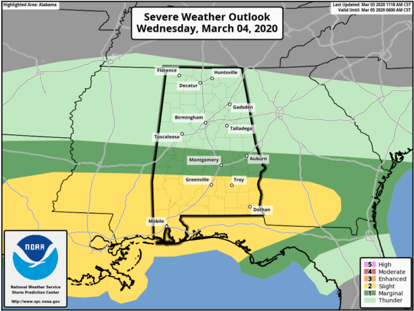
The Storm Prediction Center also has a Marginal Risk for severe storms for Wednesday for locations south of a line from Geiger (Sumter Co.) to Billingsley (Autauga Co.) to just north of Opelika (Lee Co.), while a Slight Risk is up for the extreme southern parts of Central Alabama south of a line from Sweet Water (Marengo Co.) to Fort Deposit (Lowndes Co.) to just south of Clayton (Barbour Co.).
The potential for severe storms will be there starting in the early afternoon hours on Wednesday and will persist through the remainder of the day and into the pre-dawn hours on Thursday. Damaging winds, quarter-size hail, and a few brief tornadoes may be possible over the risk locations during that time frame.
The rest of Central Alabama will have general rain and a few thunderstorms, but no organized severe weather is expected at this time, but I wouldn’t be surprised if we may have a strong storm or two with gusty winds and/or some small hail pop up. It is the start of our Spring Severe Weather Season, so expect the unexpected.
Category: Alabama's Weather, ALL POSTS, Severe Weather


